Furman Bluffs
| Furman Bluffs | ||
|---|---|---|
| location | Marie Byrd Land , West Antarctica | |
|
|
||
| Coordinates | 74 ° 6 ′ S , 113 ° 53 ′ W | |
|
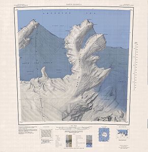
Topographic map (1: 250,000) of the Martin Peninsula with the Furman Bluffs (above) |
||
The Furman Bluffs are a series of sheer cliffs on the Walgreen Coast of Marie Byrd Land in West Antarctica . They form the southeast side of Philbin Inlet on the Martin Peninsula .
Aerial photographs of the US American Operation Highjump (1946–1947) from January 1947 were used for an initial mapping. The Advisory Committee on Antarctic Names named them in 1967 after James L. Furman of the United States Navy , staff assistant to Antarctic Task Force 43 from 1964 to 1967.
Web links
- Furman Bluffs in the Geographic Names Information System of the United States Geological Survey (English)
- Furman Bluffs on geographic.org (English)

