Giessbachfall (Wädenswil)
| Giessbach Falls | ||
|---|---|---|
|
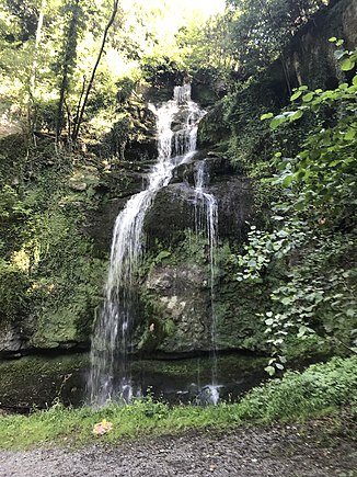
Giessbachfall in the Giessen district in the city of Wädenswil, 2020 |
||
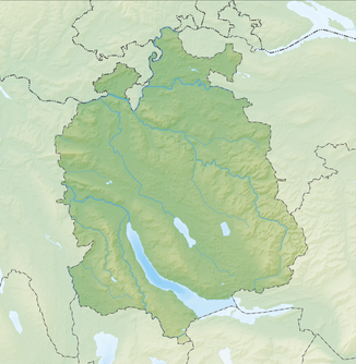
| Coordinates | 694 386 / 230 828 | |
|
|
||
| place | Giessen , Wädenswil , Canton of Zurich , Switzerland | |
| height | 20 m | |
| flow | Reidbach → Lake Zurich | |
The Giessbachfall is a waterfall in the Giessen district in the political municipality of Wädenswil . After the Rhine Falls , it is considered the highest waterfall in the Canton of Zurich .
In the Giessbachfall, the Giessbach flows over a twenty meter high wall of sandstone and Nagelfluh . The waterfall is located around 300 meters from the mouth of the stream in Lake Zurich in a small wooded cut between the Wädenswil – Einsiedeln railway line and the Seestrasse / Zürichseebahn .
The names Giessbach and Giessen refer to this waterfall, as the Old High German word "giezo" means flowing water or waterfall . The earliest mention is in 1408 as "Giesse". Giessbach is the name of the lowest section of the Reidbach, from the Zinggeler pond on Einsiedlerstrasse to the confluence with Lake Zurich on the Giessenhorn. The lower stream is also marked as Reidbach on the national map and cantonal plans.
Web links
Individual evidence
- ↑ Location of the Giesbach Falls in the national map
- ^ A b brooks in Wädenswil, 2013 yearbook of the city of Wädenswil Peter Ziegler, Wädenswil
- ↑ From the history of the red color in Giessen, Giessbach and Giessen, Yearbook of the City of Wädenswil 1994 Peter Ziegler, Wädenswil
- ↑ National map of Switzerland - swissTLM3D water network: water course number CH0055810000. In: map.geo.admin.ch. Federal Office of Topography swisstopo, accessed on July 9, 2020 .
- ↑ GIS browser. In: maps.zh.ch. Office for Spatial Development, Canton of Zurich, accessed on July 9, 2020 .

