
Gishwati forest

The Gishwati Forest ( Forêt Naturel de Gishwati ) used to be the second largest natural forest in Rwanda after the Nyungwe Forest . The afro-montane forest stretched along the Central African rift system on the east bank of Lake Kivu southeast of the lake town of Gisenyi and was once connected to the Nyungwe forest further south.
The extent of the Gishwati Forest as it is still shown on most maps no longer exists today. Today - as can also be seen on NASA satellite images - only a few patches of forest remain. Instead, there are new settlements, freshly cleared fields and tea plantations there today . The Gishwati forest has been largely destroyed for the purpose of agricultural development .
In 1960, 28,000 hectares were covered with forest. The Gishwati was cleared in several batches, including by those returning from the civil war after 1994 , so that only 1,500 acres were covered with forest in the year . The relatively small Gishwati Forest Reserve , which in 2009 only covered 700 hectares, is managed by MINIRENA / NAFA. An attempt is made to at least preserve this area with natural boundaries of stones and hedges. As a result of deforestation , landslides and flooding of fields and settlements in the valleys during the rainy season are the result.
Flora and fauna
Due to the deforestation of the high population pressure in Rwanda and refugees from the Congo biodiversity is severely damaged, 99.7% of the animal population has disappeared (Ostafrikanischer chimpanzee Pan troglodytes schweinfurthii , Angola Colobus Colobus angolensis ruwenzorii , Potamochoerus porcus , Cephalophus nigrifons , Dendrohyrax arboreus , Felis serval and Felis aurata ), the wild fruits that played an important role for the people who used to live there, have lost 93.3%, wild vegetables disappeared by 99.6%, wild medicinal plants by 79.9%.
The Gishwati Area Conservation Program (GACP), which was launched in 2007, was expanded in 2010 with a project for a 30 km long forest corridor between Gishwati and Nyungwe forests in order to enable the hardly existing wild animals to migrate. These conservation programs are designed to help reforest Rwanda by 2020; The environmental goal is to cover the national territory with 30% forest. The Rwandan Ministry of Lands and Environment is responsible. In the long term, it is planned to protect other former areas in addition to the current three national parks so that further national parks can be established. In the future Gishwati National Conservation Park , in addition to zones for nature conservation and tourism, areas with sustainable forest management are also to be designated. In the connected Nyungwe National Park there is a partnership with the National University of Rwanda .

the hills with remains of the forest in the valley, 2004
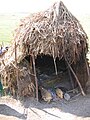
Shepherds' hut, 2004

Livestock farming in the mountains of the Gishwati forest area

on the right a ruined house


Individual evidence
- ^ Gishwati Forest - comparative satellite images 1986/2009 . NASA Earth Observatory. Retrieved January 18, 2014.
- ↑ a b Gishwati National Conservation Park - The Newest National Park in Rwanda , Rwanda Development Board, Ministry for Forests and Natural Resources, 2011 (English), accessed January 20, 2014.
- ↑ a b Elizabeth Kironde: Rwanda State of Environment and Outlook 2009 (PDF), (English) . Rwanda Environmental Management Authority (REMA). Retrieved January 18, 2014.
Coordinates: 1 ° 47'26.9 " S , 29 ° 27'15.3" E.