Grevelingen (Netherlands)

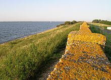
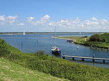
The Grevelingen is a former bay on the Dutch coast. Despite its damming ( Grevelendingam 1965, Brouwersdam 1971), its salinity is close to that of the North Sea.
geography
The Grevelingen lies between the islands of Schouwen-Duiveland ( province of Zeeland ) and Goeree-Overflakkee ( province of South Holland ). On the west side, towards the North Sea, the Grevelingen is closed by the Brouwersdam, on the east side, towards the Oosterschelde , by the Grevelingenam. A lock at Bruinisse on the Oosterschelde was built for shipping .
The result was the largest saltwater lake in Europe with a total area of 140 km² (14,000 hectares), of which 3,000 hectares fell dry. Some sandbanks have become islands (including Hompelvoet), where many water birds nest or find food. The water surface is 11,000 hectares, of which 7,000 hectares are over 1.50 meters deep. The length is 23 km, the width 4–10 km. The greatest depth is 48 m and the water level averages 0.20 m below NAP .
nature
It is in nature's interest that the Grevelingen water remains salty. That is why the Brouwerssluis is located in the Brouwersdam , a sluice that is open in both directions all year round, except for 30 days between September and December. Seals and even harbor porpoises , called Phocoena phocoena , have occasionally been seen in the Grevelingen Sea hunting for herring.
With the reopening of the Flakkeese Spuisluis in Grevelingenam, which has been closed since 1987 and which was also enlarged and modified in 2017, there is now a connection between the Osterschelde and the Grevelingen, both at high tide and at low tide on the Osterschelde. The water exchange has been in both directions for the first time since 2017 and is intended to help improve the water quality in Grevelingen. The lake is an important nature reserve.
economy

In addition to oyster fishing, tourism and water sports are economically important . Several marinas have been created in the neighboring towns and on its banks.
Conflicts of Interest
There is a fierce controversy about the further development of the Grevelingen: Agricultural representatives would like to keep the tidal shielding and the lowest possible salt content. Environmental and nature conservation representatives want to keep the salinity high and increase the influence of the tides. They point out that there is no more life at depths of more than 8 meters because the water has lost its dynamism due to the damming.
Web links
- Staatsbosbeheer website (Dutch)
- MeerGrevelingen website (German, Dutch, English)
- Website for water sports enthusiasts (German)
Individual evidence
- ↑ https://www.zwdelta.nl/projecten/flakkeese-spuisluis-als-doorlaatmiddel water exchange
- ↑ Plea against the restoration of the tidal influence (in Dutch)
- ↑ Plea for low salt content (in Dutch) ( Memento of the original from June 25, 2016 in the Internet Archive ) Info: The archive link was inserted automatically and has not yet been checked. Please check the original and archive link according to the instructions and then remove this notice.
- ^ Een inrichting voor de Grevelingen - Plea to increase the influence of the tides
Coordinates: 51 ° 45 ′ 21 ″ N , 3 ° 53 ′ 33 ″ E

