Bruinisse
 flag |
 coat of arms |
| province |
|
| local community |
|
|
Area - land - water |
13.17 km 2 12.07 km 2 1.1 km 2 |
| Residents | 3,880 (Jan 1, 2017) |
| Coordinates | 51 ° 40 ′ N , 4 ° 6 ′ E |
| Important traffic route |
|
| prefix | 0111 |
| Postcodes | 4301, 4307-4308, 4311, 4675, 5446 |
| Website | Homepage of Bruinisse |
| Location of Bruinisse in the municipality of Schouwen-Duiveland | |
Bruinisse ( Zeeland Brunisse or Bru ) is a village in the far east of the island Schouwen-Duiveland and lies between Rotterdam and Vlissingen in the Netherlands . Bruinisse belongs to the municipality of Schouwen-Duiveland in the province of Zeeland , its population was 3,880 in January 2017.

Bruinisse was one of the last areas on the island of Duiveland to be diked in 1467 by Adriaan van Borsele. The mud flats in the surrounding area were ideal for mussel farming , so that this branch of industry (until 1963) together with oyster farming became an important source of income. In the fishing museum (Visserijmuseum in the Oudestraat) this part of the past comes to life. Part of today's mussel ship fleet is located in the port of Zijpe (east port). In the former port of call for the ferry between Anna-Jacobapolder and Zijpe, mussels are now grown in hanging culture.
There are 30 fishing ships in Bruinisse, they and tourism shape the place. On the dike at the Grevelingenmeer there is a sculpture of an open shell. The main traffic connection is the Rijksweg 59 , which runs on the dike built in 1468 in the northeast of Bruinisse.
Bruinisse hardly has any historical buildings. The center of the village was once ring-shaped. The old development has not been maintained since the storm surges. The main source of income is tourism and mussel fishing. Until 1997 Bruinisse was an independent municipality.
lock

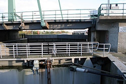
In Bruinisse there is a lock through which ships can commute between the tidal complex of the Oosterschelde and the stagnant Grevelingen. This lock should not be confused with a second lock in Grevelingen, which, together with a lock in the opposite Brouwersdam, ensures that the salt content in Europe's largest saltwater lake, the Grevelingen, is around 16 per thousand. This makes sense for ecological reasons. These two locks, reserved for rinsing, were built later when it was discovered that the overhang of precipitation was sweetening the lake more and more and thus the goal of preserving a salt water lake was no longer guaranteed. He threatened to go crazy. The lake, however, had to remain salty due to a long-discussed decision of the Dutch parliament, which was underpinned by much scientific work. Through the lock in Brouwersdam, sea water with 35 per mille can be admitted, through the flushing lock (not ship lock!) In Grevelendam a corresponding amount of clogging water is discharged. The shipping lock in Bruinisse, on the other hand, compensates for the difference in altitude between Grevelingen and the North Sea (Oosterschelde) so that ships from the marinas can sail on the North Sea. The Rijksweg 59 runs since 2007 through two parallel bridges, one sliding bridge and a bascule bridge , making it at the gate will be no traffic delays.
The two flushing sluices in Brouwersdam and Grevelingenam do not impair the flow of traffic on the dams. They cannot be seen from the street.
The village of Bruinisse hosts the Visserijdagen (fishing days), which take place every year on the 3rd weekend of July.

literature
- Gerhard Kirfel: The Grevelingen beach - an offer for the spatial integration of traditional and ecologically motivated recruitment claims; Dissertation at the University of Oldenburg 1984
Web links
- Place website (Dutch)
- Bruinisse: Website of the tourist association VVV Zeeland (German, Dutch, English)
- Visserijdagen website (Dutch)
Individual evidence
- ↑ a b Kerncijfers wijken en buurten 2017 Centraal Bureau voor de Statistiek , accessed on April 8, 2018 (Dutch)
- ↑ Mosselvloot retrieved (Dutch) on April 9, 2018


