Ouwerkerk
 flag |
 coat of arms |
| province |
|
| local community |
|
|
Area - land - water |
10.69 km 2 9.95 km 2 0.74 km 2 |
| Residents | 600 (Jan. 1, 2017) |
| Coordinates | 51 ° 38 ′ N , 3 ° 59 ′ E |
| prefix | 0111 |
| Postcodes | 4305-4306, 4675 |
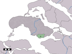
| Location of Ouwerkerk in the municipality of Schouwen-Duiveland | |
Ouwerkerk ( Zeeland Ouwerkaarke ) is a village in the Dutch province of Zeeland . It belongs to the municipality of Schouwen-Duiveland and is probably the oldest village on the former island of Duiveland. The medieval parish church was destroyed in the Second World War and replaced by a new building in 1956.
Ouwerkerk had 600 inhabitants in January 2017. It was an independent municipality until 1961, before it came to the municipality of Duiveland, which was expanded to become the municipality of Schouwen-Duiveland in 1997.
Ouwerkerk was badly hit in the flood disaster of 1953 , a sixth of the total population perished and the town's dike was the last to be closed over a year after the disaster. The Watersnood Museum is located in one of the caissons that were used to temporarily close the dike breach (NS = 51.617455 | EW = 3.981983) .
Web links
- Ouwerkerk: Website of the tourist association VVV Zeeland (German, Dutch, English)
- Pictures of the place (Dutch)
- Watersnoodmuseum website (German, Dutch, English, French)
Individual evidence
- ↑ a b Kerncijfers wijken en buurten 2017 Centraal Bureau voor de Statistiek , accessed on April 8, 2018 (Dutch)
