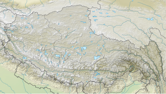
Gyatso La
| Gyatso La | |||
|---|---|---|---|
|
Gyatso La, pass height |
|||
| Compass direction | North | south | |
| Pass height | 5248 m | ||
| Autonomous area | Tibet | ||
| Valley locations | Chawuxiang | Jiacuoxiang | |
| expansion | Pass road | ||
| Mountains | Himalayas | ||
| map | |||
|
|
|||
| Coordinates | 28 ° 57 '7 " N , 87 ° 26' 14" E | ||
Gyatso La or Jia Tsuo La , also Lhakpa La , is an approximately 5248 m high mountain pass in Tibet . The connecting road leads over the top of the pass from the Nepalese capital Kathmandu to the Tibetan capital Lhasa . Southeast of the pass is the village of Tingri , north of the city Lhaze . The “ Qomolangma National Nature Reserve ” begins at Gyatso La and corresponds to the UNESCO designated Qomoalangma Biosphere Reserve . Qomolangma is a spelling for the Tibetan (Chinese) name of Mount Everest .

