Hüttingen (Beckerich)
|
Hüttingen ( German ) Hitten ( lux. ) Huttange ( French ) Beckerich municipality
|
||
|---|---|---|
| Coordinates : | 49 ° 44 ' N , 5 ° 54' E | |
| Postal code : | 8539 | |
|
Location of Hüttingen in Luxembourg
|
||
|
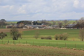
View of Hüttingen
|
||
Hüttingen ( Luxembourgish Hitten , French Huttange ) is a village with 18 inhabitants (as of July 2006 ) in the municipality of Beckerich in the canton of Redingen in the Grand Duchy of Luxembourg .
location
The village lies at the confluence of the streams Mollbach and Mühlenbach from then on the body of water bears the name Noerdinger Bach. The national road 24 runs through the town, neighboring towns are Beckerich in the west and Noerdingen in the east.
General and history
Hüttingen is the smallest part of the municipality and was first mentioned in a document in 1236.
The village has a chapel built in 1714, which is dedicated to St. Sigismund . It is a simple two-axis baroque building with a roof turret.
literature
- Nicolas Bosseler: Beckerich, Hüttingen and Levelingen, in their fateful history through the centuries , Krippler & Cie 1975, pp. 255–257.
Web links
Commons : Hüttingen - Collection of images, videos and audio files
Individual evidence
- ↑ The Beckerich community in figures ( Memento of the original from March 4, 2014 in the Internet Archive ) Info: The archive link was automatically inserted and not yet checked. Please check the original and archive link according to the instructions and then remove this notice.

