Beckerich
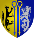
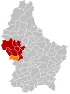
| coat of arms | map |
|---|---|

|

|
| Basic data | |
| State : |
|
| Coordinates : | 49 ° 44 ' N , 5 ° 53' E |
| Canton : | Redingen |
| Residents : | 2619 (January 1, 2019) |
| Area : | 28.4 km² |
| Population density : | 92.2 inhabitants / km² |
| Municipality number: | 0701 |
| Website: | www.beckerich.lu |
| politics | |
| Mayor: | Thierry Lagoda |
| Elective system : | Majority vote |
Beckerich ( Luxembourgish Biekerech ) is a municipality in the Grand Duchy of Luxembourg and belongs to the canton of Redingen .
Composition of the community
The municipality of Beckerich consists of the following eight localities:
- Beckerich (638)
- Elvingen (108)
- Hovelingen (259)
- Huettingen (28)
- Levelingen (47)
- Noerdingen (511)
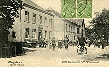
- Oberpallen (455)
- Schweich (201)
history
Celts have already held their ritual celebrations on the Kahlenberg.
The Beckerich mill is already on the Ferraris map from 1777. The mill pond with its trees on the banks and the neighboring Mëlleschbur wetland with its springs represent a valuable cultural and natural heritage for the community to this day.
Individual evidence
- ↑ STATEC Luxembourg - Population par canton et commune 1821–2019 (French)
- ↑ Presentation de la commune. ( Memento of the original from April 9, 2010 in the Internet Archive ) Info: The archive link was inserted automatically and has not yet been checked. Please check the original and archive link according to the instructions and then remove this notice.
Web links
Commons : Beckerich - Collection of images, videos and audio files
