Ram break
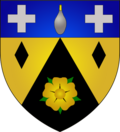
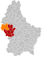
| coat of arms | map |
|---|---|

|

|
| Basic data | |
| State : |
|
| Coordinates : | 49 ° 50 ' N , 5 ° 51' E |
| Canton : | Redingen |
| Residents : | 4419 (January 1, 2019) |
| Area : | 79.1 km² |
| Population density : | 55.9 inhabitants / km² |
| Municipality number: | 0704 |
| Website: | www.rambrouch.lu |
| politics | |
| Mayor: | Antoine Rodesch ( CSV ) |
| Elective system : | Majority vote |
Rambruch ( Luxembourgish Rammerech , French Rambrouch ) is a municipality in the Grand Duchy of Luxembourg and belongs to the canton of Redingen . It was created on January 1, 1979 through the merger of the municipalities of Arsdorf, Bondorf, Folscheid and Perl.
The third highest point in the country, the Napoléonsgaard at 549 meters, is located in the municipality .
When Luxembourgish and Moselle Franconian are assigned to the German dialect continuum , the municipality of Rambruch represents the westernmost point of the closed German-speaking area in Central Europe. The counterpart is the municipality of Deutsch Jahrndorf in Austria, 850 kilometers to the east .
Daughters and sons of the church
- Albert Wingert (1897–1962), teacher, politician and resistance activist against National Socialism, born in Holtz
Composition of the community
The municipality of Rambruch consists of the following localities:
- Arsdorf
- Bondorf
- Bilsdorf
- Escheid
- Folscheid
- Obermartelingen
- Holtz
- Hostert
- Kötscheid
- Pearl
- Ram break
- Rombach-Martelingen
- Schwiedelbruch
- Wolwelingen
Individual evidence
Web links
Commons : Rambruch - collection of images, videos and audio files
