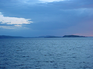
Hamilton Inlet
| Hamilton Inlet | ||
|---|---|---|
|
Hamilton Inlet (taken on the ferry between Cartwright and Happy Valley-Goose Bay) |
||
| Waters | Labrador Sea | |
| Land mass | Labrador Peninsula | |
| Geographical location | 54 ° 18 ′ N , 57 ° 54 ′ W | |
|
|
||
| length | approx. 80 km | |
| Tributaries | Churchill River , Naskaupi River | |
Hamilton Inlet is the name of a fjord - or fjärd - like bay on the Labrador coast in the Canadian province of Newfoundland and Labrador . Groswater Bay forms the outer part . Together with Lake Melville , an inland bay, Hamilton Inlet forms the largest estuary in the province. This extends over 140 kilometers inland to the town of Happy Valley-Goose Bay . The bay is fed by the river systems of the Churchill River and the Naskaupi River .
Lake Melville is regarded as part of the Hamilton Inlet; it extends west of the deep and narrow passage near the municipality of Rigolet .
Akami-Uapishkᵁ-KakKasuak-Mealy-Mountains National Park lies on its southeastern bank .
In 1586 the expedition of John Davis was attacked by Inuit , who killed two expedition members and wounded others.
Web links
- Hamilton Inlet at Natural Resources Canada
Individual evidence
- ^ Libraries and Archives Canada. " John Davis, the Master Navigator ". Accessed 10 May 2012.

