Hanö Bay
Coordinates: 55 ° 51 ′ 0 ″ N , 14 ° 20 ′ 0 ″ E

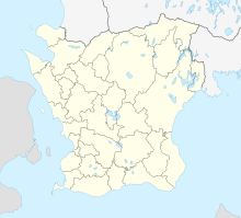
The Hanöbucht ( Swedish Hanöbukten ) is a bay on the Baltic coast of the Swedish provinces of Skåne län and Blekinge län . The name Hanöbukten comes from the small island Hanö , which is located in the sea off the Listerlandet peninsula .
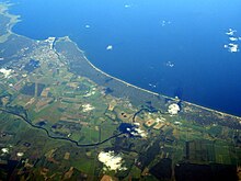
The bay extends from Listerlandet in the north to Stenshuvud and Bornholm Island in the south; the main port cities on Hanöbucht are Sölvesborg , Åhus and Kivik . Along the Hanöbucht, from Åhus to Julleboda in the south, there is an approximately 20 km long dune landscape with a long sandy beach that is well suited for swimming. The region by the bay is therefore shaped by tourism . With east or southerly winds, the water gets colder because cold currents are driven upwards from the depths.
The rivers Helge å , Skräbeån , Julebodaån and Verkaån flow into Hanöbucht . The greatest depth of Hanöbucht is over 60 meters. The salinity (salt content) is around 7.5 in the shallower to 13 per thousand in the deeper water.
The fishery focuses on herring and cod , among others . The eel , which is often smoked directly on the coast, plays a particularly important role . The east coast of Skåne, especially the one along Hanöbucht with its center Åhus, is therefore also called the Eel Coast (Ålakusten).
Web links
- Information about Hanöbucht (English)
- More information (Swedish)
Remarks
- ↑ See for example Ålakusten ( page no longer available , search in web archives ) Info: The link was automatically marked as defective. Please check the link according to the instructions and then remove this notice. on kristianstad.com


