
Hanga Roa
| Hanga Roa | |||
|---|---|---|---|
|
|||
| Coordinates | 27 ° 9 ′ S , 109 ° 26 ′ W | ||
| Basic data | |||
| Country | Chile | ||
| Valparaíso | |||
| ISO 3166-2 | CL-VS | ||
| Residents | 3304 (2002) | ||
| founding | September 9, 1888 | ||
 Easter Island map
|
|||

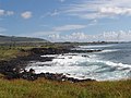
Hanga Roa , the only town of the southeastern Pacific located to Chile belonging to Easter Island . The place has 3304 inhabitants (according to the 2002 census) and is located on the south west coast of the island.
The city is home to all of the island's major infrastructure facilities. The anthropological museum Museo Antropológico Sebastián Englert , named after the German missionary and linguist Sebastian Englert , shows artifacts from the island's history and provides information about the Rapa Nui culture. The place is also home to the island 's only port and Cook's Bay , the place where the British explorer James Cook landed in 1774. Ships of the German East Asia Squadron were also in this bay from October 12 to 18, 1914. The squadron was destroyed about a month and a half later in a naval battle near the Falkland Islands .
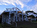
Immediately south of Hanga Roa is Mataveri International Airport ( IATA airport code : IPC), the island's international airport. Hanga Roa is also home to the island's only Catholic church building, the Iglesia Santa Cruz , where the grave of the missionary Eugene Eyraud is located.
Up until the middle of the 19th century there were five more settlements on the island, namely Anakena, Tongariki, Vaihu, Vinapu and Mataveri, four of which have disappeared and one has merged with Hanga Roa. In 1914, around 250 people lived in Hanga Roa.
gallery
Hanga Roa - Easter Island

Hanga Roa harbor

At the port

Main road
Roman Catholic Church


