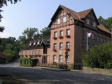
Heiligenthal (Südergellersen)
|
Heiligenthal
Community Südergellersen
|
||
|---|---|---|
| Coordinates: 53 ° 13 ′ 9 ″ N , 10 ° 20 ′ 12 ″ E | ||
| Height : | 6 m above sea level NN | |
| Residents : | 381 | |
| Incorporation : | March 1, 1974 | |
| Postal code : | 21394 | |
| Area code : | 04135 | |
|
Location of Heiligenthal in Lower Saxony |
||
Heiligenthal is a district of the municipality of Südergellersen in Lower Saxony .
history
On March 1, 1974 Heiligenthal was incorporated into the community of Südergellersen.
Population development
| year | 1925 | 1933 | 1939 |
|---|---|---|---|
| Residents | 133 | 160 | 146 |
religion
The place was parish in the parish of Kirchgellersen in 1848 and had its own chapel of the aristocratic manor.
Individual evidence
- ↑ a b Search for geographical names. Federal Agency for Cartography and Geodesy, 2017, accessed on April 3, 2017 .
- ↑ Lutz Tetau: About the Municipality. Südergellersen community, accessed on April 3, 2017 .
- ^ A b c Michael Rademacher: German administrative history from the unification of the empire in 1871 to the reunification in 1990. City and district of Lüneburg. (Online material for the dissertation, Osnabrück 2006).
- ↑ Friedrich W. Harseim, C. Schluter (ed.): Statistical Manual for the Kingdom of Hanover . Schlueter, 1848, p. 232 ( limited preview in Google Book search).


