Hengifoss
| Hengifoss | ||
|---|---|---|
|
The Hengifoss |
||
| Coordinates | 65 ° 5 '44.49 " N , 14 ° 53' 24.6" W | |
|
|
||
| place | Egilsstaðir , Iceland | |
| height | 118 m edge of fall : 450 m |
|
| width | 11 m | |
| flow | Hengifossá → Lagarfljót | |
The Hengifoss with a height of 118 m after the Morsárfoss , the Glymur and the Háifoss the fourth highest waterfall Islands .
geography
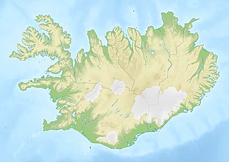
The Hengifoss is located in the east of Iceland, southwest of the town of Egilsstaðir and near the southern part of the lake Lagarfljót .
description
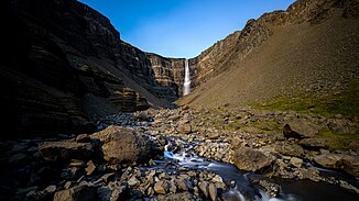
Like the Litlanesfoss located downstream, the Hengifoss is fed by the Hengifossá river, a tributary of the Lagarfljót. Its water plummets from 450 m above sea level .
In the lava background of the waterfall you can find reddish, granular clay layers that have formed from volcanic ash ( tephra ). They get their reddish color from the iron oxide they contain .
See also
Web links
Commons : Hengifoss - collection of images, videos and audio files
Individual evidence
- ^ Hengifoss, Iceland. Retrieved October 29, 2017 .
- ↑ nat.is - Hengifoss
- ↑ a b Information board at Hengifoss
- ↑ Jens Willhardt, Christine Sadler: Iceland . 3rd updated and revised edition. Michael Müller, Erlangen 2003, ISBN 3-89953-115-9 , p. 390.

