Historic Union Pacific Rail Trail State Park
|
Historic Union Pacific Rail Trail State Park
|
||
|
The Rail Trail at Wanship |
||
| location | Summit County in Utah (USA) | |
| Geographical location | 40 ° 40 ′ N , 111 ° 30 ′ W | |
|
|
||
| Setup date | 1992 | |
| administration | Utah Dept. of Natural Resources, Division of State Parks and Recreation | |
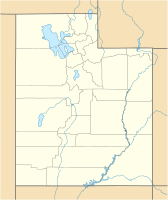
The Historic Union Pacific Rail Trail State Park is located in Summit County of the US state of Utah . The state park runs over a distance of 45 kilometers on the former embankment from Park City via Wanship and Coalville to the Echo Reservoir , in places also parallel to Interstate 80 .
The Coalville and Echo Railroad began construction of a railway line from Echo to the coal mines at Coalville in 1869. The project did not get beyond the construction of the substructure. In 1873, the Summit County Railroad , founded in 1871, took over these facilities and built a narrow-gauge railway with a gauge of 3 feet (914 mm) on them. After silver ore was discovered in Park City, the company built a standard gauge railroad into the city in 1881. At the same time, the existing line between Echo and Coalville was converted to standard gauge. In the same year, the Union Pacific Railroad founded the Echo and Park City Railway and took over the Summit County Railroad, which was already controlled by the Union Pacific.
Over 100 years later, the Union Pacific Railroad shut down the line in 1989. The Historic Union Pacific Rail Trail State Park opened in 1992 as the first rail trail in Utah that is exclusively reserved for non-motorized traffic. This includes hiking, cycling and horse riding as well as cross-country skiing if there is enough snow in winter.
Previously, tracks and sleepers were removed and historical fences on the outer edge of the railway embankments and thus the state park were added to clearly mark the boundaries of the adjacent farmland. The texture of the surface is different. A trestle bridge , 15 historical wooden bridges and 100 culverts are crossed.
The route profile has an average gradient of 2 degrees, with 2100 m in Park City and 1600 m in Echo Reservoir. Along the state park there are pastures and wetlands, among other things, in Silver Creek Canyon you can see herons and bald eagles , elk and deer, as well as fox and beaver
Individual evidence
- ↑ http://stateparks.utah.gov/parks/historic-union
- ↑ Archive link ( Memento of the original from January 23, 2012 in the Internet Archive ) Info: The archive link was inserted automatically and has not yet been checked. Please check the original and archive link according to the instructions and then remove this notice.
- ↑ http://pdfhost.focus.nps.gov/docs/NRHP/Text/96000413.pdf
- ↑ http://www.americantrails.org/nationalrecreationtrails/trailNRT/unionpacific-ut.html


