Goosenecks State Park
|
Goosenecks State Park
|
||
|
Aerial view of the Goosenecks |
||
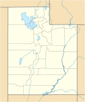
| location | San Juan County in Utah (USA) | |
| Geographical location | 37 ° 10 ' N , 109 ° 56' W | |
|
|
||
| Setup date | 1962 | |
| administration | Utah Dept. of Natural Resources, Division of State Parks and Recreation | |
The Goosenecks State Park is a state park in the southeast of the US state of Utah , not far from Hat Mexican and Monument Valley . From the lookout point (which is around 1500 m above sea level) you can take a look at the San Juan River , which has dug itself a good 300 m deep over the course of millions of years. The river meanders back and forth over a length of 8 km and covers just 1.6 km as the crow flies.
Unlike most state and national parks, there is no visitor center here . At the lookout there are a few simple tables and benches for picnics and toilets. From a bird's eye view, the structures that the San Juan River has created look like goose necks, hence the name Goosenecks State Park (see also NASA photo under the web links).


