Kodachrome Basin State Park
|
Kodachrome Basin State Park
|
||
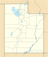
| location | Kane County in Utah (USA) | |
| surface | 16.2 km² | |
| Geographical location | 37 ° 31 ' N , 112 ° 0' W | |
|
|
||
| Setup date | 1962 | |
| administration | Utah Dept. of Natural Resources, Division of State Parks and Recreation | |
The Kodachrome Basin State Park is a small, quiet and popular State Park in Utah , USA. It is located a few miles south of Utah State Route 12 and about 30–35 km southeast of Bryce Canyon National Park . It is accessible from the north via a paved road from Tropic, Utah and from the south via the unpaved Utah Road 400 from Page , Arizona . Located at an altitude of approx. 1800 m, the 16.2 km² park area has a predominantly dry climate.
In the state park's basin there are heavily eroded rock formations in different hues of red, yellow, pink, white and brown. This natural play of colors is complemented by the deep blue sky at best and the occasional green vegetation. This wide range of colors was seen by participants on an expedition of the National Geographic Society that explored the site in 1948. In an article in National Geographic magazine about this exploration, the area was named Kodachrome Flat , after Kodak's color-rich slide film Kodachrome . In 1962, the Chimney Rock State Park was established there because legal consequences were feared from the use of the brand name. A few years later, the Kodak Corporation gave permission to use it so that it could be renamed Kodachrome Basin State Park .
A special feature in the park area is the occurrence of numerous pointed rock needles and rock chimneys, the origin of which is explained by the deposition and sedimentation in former geysers, which then remained as harder rock when later weathering processes eroded away the original soil around them.
Web links
- Official website (English)
- Kodachrome Trails by Todd's Desert Hiking Guide
- Kodachrome Basin State Park on the United States Geological Survey's Geographic Names Information System
Individual evidence
- ↑ http://www.desertusa.com/kodut/du_kodut_vvc.html
- ↑ Jack Breed: First Motor Sortie into Escalante Land Utah By Jack Breed. In National Geographic magazine , September 1949, pp. 369-404. "The few natives who had been here called this area" Thorny Pasture, "but we renamed it" Kodachrome Flat "because of the astonishing variety of contrasting colors in the formations."
- ↑ http://www.clui.org/lotl/v33/m.html
- ↑ Archived copy ( memento of the original dated November 30, 2010 in the Internet Archive ) Info: The archive link was inserted automatically and has not yet been checked. Please check the original and archive link according to the instructions and then remove this notice.


