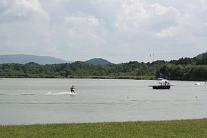
Horecký rybník
| Horecký rybník Vodní nádrž Horka, Great Horka Pond |
|||||||
|---|---|---|---|---|---|---|---|
|
|||||||
|
|
|||||||
| Coordinates | 50 ° 42 '2 " N , 14 ° 48' 47" E | ||||||
| Data on the structure | |||||||
| Lock type: | dam | ||||||
| Construction time: | 1912–1915, reconstruction 1996–2001 | ||||||
| Height of the barrier structure : | 5.25 m | ||||||
| Crown length: | 950 m | ||||||
| Crown width: | 5 m | ||||||
| Data on the reservoir | |||||||
| Water surface | 75.5 ha | ||||||
The Horecký rybník , also Vodní nádrž Horka (German Great Horka pond ), is a reservoir in northern Bohemia.
It is located on the eastern outskirts of Stráž pod Ralskem above the confluence of the Ještědský potok ( Jeschkenbach ) in the Ploučnice flowing from Hamr na Jezeře . The dammed body of water is the Ploučnice.
The original stately fish pond was expanded into a reservoir between 1912 and 1915. It has a water surface of 75.5 hectares and is dammed in the north by a 5.25 meter high dam. The top of the dam is 950 m long and 5 m wide.
The pond was reconstructed between 1996 and 2001. It is used for recreational purposes.
Web links
Commons : Vodní nádrž Stráž pod Ralskem - collection of pictures, videos and audio files

