Hreðavatn
| Hreðavatn | ||
|---|---|---|

|
||
| Hreðavatn | ||
| Geographical location | Borgarbyggð , Iceland | |
| Tributaries | Kiðá u. a. | |
| Drain | Hrauná → Norðurá | |
| Data | ||
| Coordinates | 64 ° 45 ′ 31 ″ N , 21 ° 35 ′ 13 ″ W | |
|
|
||
| surface | 1.3 km² | |
| length | 5 km | |
| Maximum depth | 20 m | |
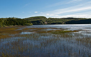
The Hreðavatn is a lake in the west of Iceland in the area of Borgarbyggð .
geography
It is located about 25 km north of Borgarnes near the Hringvegur (ring road no. 1) at the University of Bifröst . The Grábrók craters rise not far away and their lava also extends along the eastern shore of the lake.
The length of the Hreðavatn is approx. 5 km, its area 1.3 km², its depth approx. 20 m.
You can fish trout in the lake .
The immediate area is characterized by a large lava field, gentle heathland and small forest plantings (see reforestation ). The area must have been forested in earlier times. About 6.5 - 7 million years old charcoal seams have been discovered here, the composition of which points to species that are native to Central Europe today. This suggests that the climate back then was much milder than it is today.
Not too far away is the perfect cone of the Baula .
See also
Web links
- http://www.nat.is/nateng/hredavatn.htm (English)
- http://www.iww.is/pages/xw/wl.html (English, with photo)
- Photo of the Hreðavatn
