
Borgarbyggð

|
|
| Basic data | |
|---|---|
| State : |
|
| Region: | Vesturland |
| Constituency : | Norðvesturkjördæmi |
| Sýsla : | Mýrasýsla |
| Population: | 3807 (January 1, 2019) |
| Surface: | 4926 km² |
| Population density: | 0.77 inhabitants / km² |
| Post Code: | 310, 311 (Borgarnes) |
| politics | |
| Community number | 3609 |
| Contact | |
| Address of the municipal administration: | Borgarbraut 11 310 Borgarnesi |
| Website: | www.borgarbyggd.is |
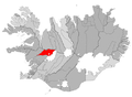
| map | |

Coordinates: 64 ° 32 ′ N , 21 ° 55 ′ W |
|
Borgarbyggð municipality is an Icelandic municipality in the Vesturland region .
On January 1, 2019, the community had 3,807 inhabitants. The two largest settlements in Borgarbyggð are Borgarnes with 2012 inhabitants and Hvanneyri with 307 inhabitants (as of January 1, 2019).
geography
Borgarbyggð is located in the west of Iceland. The municipality borders the Faxaflói to the west, the Haffjörður with the island Gamlaeyri and the municipality Eyja- og Miklaholtshreppur to the northwest . In the northwest of the municipality is the lava field Eldborgarhraun and the Hnappadalur with the two lakes Oddastaðavatn and Hlíðavatn . East of these lakes is the lake Hítarvatn , further southeast of the Langavatn , even further east of the Hreðavatn with the place Bifröst. In the south-west of Borgarbyggð is the lake-rich area of Mýrar .
To the north of the municipality are the municipalities Dalabyggð and Húnaþing vestra , northeast Húnavatnshreppur . In the southeast of the municipality are the mountain Strútur and the lava field Hallmundarhraun near the Eiríksjökull glacier . The large glacier Langjökull with its side glacier Geitlandsjökull , the shield volcano Ok and the Kaldidalur are located in the east and south-east of the municipality. South-east of Borgarbyggð lies the community Grímsnes- og Grafningshreppur with the Þórisjökull , parts of which belong to Borgarbyggð. To the south of Borgarbyggð lie the municipalities of Skorradalshreppur and Hvalfjarðarsveit .
Parts of the municipality are in the Icelandic highlands .
The river Hvítá flows into the Borgarfjörður , where the main town of Borgarnes is located. Well-known waterfalls are the Hraunfossar and the Barnafoss .
history
The municipality of Borgarbyggð was formed on June 11, 1994 by the merger of four municipalities: These were:
- the municipality of Borgarnes ( Borgarnesbær )
- the rural municipality of Norðurárdalur ( Norðurárdalshreppur )
- the rural community of Stafholstungur ( Stafholstungnahreppur )
- the rural community of Hraun ( Hraunhreppur ).
On June 7, 1998, the rural communities Álftanes ( Álftaneshreppur ), Borg ( Borgarhreppur ) and Þverárhlíð ( Þverárhlíðarhreppur ) were incorporated.
On May 27, 2006, the municipality of Borgarbyggð was merged with the following municipalities to form the new municipality of Borgarbyggð:
- Borgarfjarðarsveit: Borgarfjarðarsveit had 732 inhabitants in 2005 and had a size of 1,254 km². It was formed on June 7, 1998 through the merger of the four rural communities Andakílshreppur, Lundarreykjadalur ( Lundarreykjadalshreppur ), Reykholtsdalur ( Reykholtsdalshreppur ) and Hálsahreppur. The three largest settlements were Hvanneyri with 230 inhabitants, Kleppjárnsreykir with 50 inhabitants and Reykholt with 33 inhabitants (as of 2005).
- Hvítarsíða ( Hvítarsíðuhreppur ): Hvítársíða had 83 inhabitants in 2005 and had a size of 1,482 km². Hvítársíða was one of the few communities in Iceland that did not border the sea. It took the northern part of the Hvítá valley. The church places were Síðumúli and Gilsbakki .
- Kolbeinsstaðir ( Kolbeinsstaðahreppur ): Kolbeinsstaðir counted 102 inhabitants in 2005 and had a size of 347 km².

Location of the former municipality of Borgarfjarðarsveit
Location of the former municipality of Hvítársíða (territorial status December 2005)

Location of the former municipality of Kolbeinsstaðir (territorial status December 2005)


The alternative names Brákarbyggð , Mýrabyggð and Sveitarfélagið Borgarfjörður could not prevail among the electorate.
places
Borgarnes


The main town of the municipality of Borgarnes is located on Borgarfjörður . The Hafnarfjall volcano has cooled down nearby .
Bifröst
The private business school Háskólinn á Bifröst is located in the center of the village of Bifröst with 164 inhabitants .
Hvanneyri
The village of Hvanneyri with the agricultural college also belongs to this municipality.
Húsafell
Húsafell is especially important for tourism. Nearby are the Hallmundarhraun lava field and the Hraunfossar waterfalls .
Reykholt
The small town of Reykholt was the residence of the Goden and poet Snorri Sturluson in the Middle Ages .
Kleppjárnsreykir
The place Kleppjárnsreykir has mainly a variety of hot springs. Like Reykholt, it is located in Reykholtsdalur. The water from the springs is used to heat glass houses and to grow tomatoes, peppers and carrots. The Deildartunguhver spring is located about two kilometers from Kleppjárnsreykir.
Population development
The community is growing, especially due to the population growth in Borgarnes and Bifröst.
| date | Residents |
|---|---|
| Dec. 1, 1981: | 3,511 (area 2006) |
| Dec. 1, 1997: | 3,267 (area status 2006) |
| Dec. 1, 2003: | 3,475 (area 2006) |
| Dec. 1, 2004: | 3,447 (area 2006) |
| Dec. 1, 2005: | 3,625 (area 2006) |
| Dec. 1, 2006: | 3.713 |
| Dec. 1, 2007: | 3,742 |
| Dec. 1, 2008: | 3,747 |
statistics
| Borgarbyggð | Borgarfjarðarsveit | Hvítársíða | Kolbeinsstaðir | |
|---|---|---|---|---|
| Municipality number: | 3609 | 3510 | 3601 | 3701 |
| Post Code: | 310, 311 | 320 | 311 | 311 |
| Surface: | 1843 km² | 1254 km² | 1482 km² | 347 km² |
| Population on December 1, 1981: | 2466 (territory 1998) | 812 (territory 1998) | 83 | 150 |
| Population on Dec. 1, 1997: | 2384 (territory 1998) | 686 (territory 1998) | 82 | 115 |
| Population on Dec. 1, 2003: | 2589 | 696 | 85 | 105 |
| Population on December 1st, 2004: | 2593 | 670 | 84 | 100 |
| Population on Dec. 1, 2005: | 2708 | 732 | 83 | 102 |
| Population change 1981-2005: | + 10% | -10% | ± 0% | -32% |
Town twinning
-
 Eysturkommuna , Faroe Islands
 -
 Falkenberg , Sweden
 -
 Odsherred , Denmark
 -
 Ullensaker , Norway
Sons and daughters of the church
- Guðmundur Ingi Guðbrandsson (* 1977 on the Brúarland farm), environmental manager and politician
- Páll Guðmundsson (* 1959 in Húsafell ), sculptor
- Veturliði Óskarsson (* 1958 in Borgarnes ), philologist
Individual evidence
- ↑ Vinabæjarmót í Borgarbyggð ( Icelandic ) Ráðhús Borgarbyggðar. June 27, 2017. Retrieved January 13, 2018.
Web links
- Local government website (Icelandic)
- general information in English and Icelandic
- English information about the Egils saga