Ullensaker
| coat of arms | map | |
|---|---|---|

|
|
|
| Basic data | ||
| Commune number : | 3033 | |
| Province (county) : | Viken | |
| Administrative headquarters: | Jessheim | |
| Coordinates : | 60 ° 9 ′ N , 11 ° 11 ′ E | |
| Surface: | 252.45 km² | |
| Residents: | 39,625 (Feb 27, 2020) | |
| Population density : | 157 inhabitants per km² | |
| Language form : | Bokmål | |
| Postal code : | 2050 | |
| Website: | ||
| politics | ||
| Mayor : | Eyvind Jørgensen Schumacher ( Ap ) (2019) | |
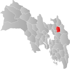
| Location in the province of Viken | ||

|
||
Ullensaker is a Norwegian municipality in Fylke Viken . Oslo Airport Gardermoen is located on their territory .
geography
Ullenaker is in the Romerike region . Until the regional reform in Norway , the municipality belonged to the former Akershus province . On January 1, 2020, this was transferred to Viken. The western border of Ullensaker is formed by the Leira River , while the eastern border largely follows the Rømua River . Both of these rivers are tributaries of the Glomma .
About half of the residents of Ullensaker live in the Jessheim administrative center . Most of the rest of the population lives in the other Tettsteden Kløfta, Sand, Sessvollmoen, Borgen, Algarheim and Nordkisa. With the exception of Nordkisa, these localities are all in the west of the municipality. In the decade from 1996 to 2006, the municipality was the one with the greatest population growth in Norway. The growth was 35.7%.
1,000 million years ago a mountain range stretched west from Sweden through the Ullensaker area. Under Ullensaker there are still primary rocks of this ancient mountain range. The mountain range was planed down during the various ice ages. When the ice retreated after the last ice age 10,000 years ago, the sea followed as far as Hamar . The rock remnants of the original mountain range remained as islands in the Romeriksfjord . They consist of gneiss and amphibolite . There is also quartz in some places.
As the pressure from the ice subsided, the land rose. Today you can observe the sea deposits up to a height of 208 meters. Today Stensbyfjell is the highest point in Ullensaker at 282 meters above sea level. There is also a military training area there. A lot of gravel was washed out of the glaciers and has since been mined. On the road south of Jessheim you can still see the folds of the mountains. A nature park is being set up nearby, which will include a geological park for researching the developments in the Ice Age.
economy
The jobs in Ullensaker are mainly found in the service sector. Many of them work for the military institutions and Oslo Gardermoen Airport. There are also commercial workers in the localities of Kløfta and Jessheim. The municipality's industrial operations are mainly located in Jessheim. Since the opening of the airport, the municipality has been the destination of many commuters from the surrounding municipalities.
traffic
Norway's largest airport, Oslo-Gardermoen, is located in Ullensaker . The European route 6 , which runs from southern Sweden to northern Norway, also passes through the municipality . There are also stops for the Hovedbanen and cloakroom lines in Ullensaker.
Coat of arms and name
The coat of arms represents the god Ullr . He was particularly venerated in Romerike in pre-Christian times . He was the best skier and greatest hunter. The name Ullensager comes from norrønen Ullinshof , the place of worship for Ullr. In the 15th century the part of the name aker was added, which means cultivated field, field.
Attractions
- Grave hill Raknehaugen , the largest grave mounds Norway
sons and daughters of the town
- Johannes Hanssen (1874–1967), composer, conductor and military musician
Web links
- Ullensaker in the store norske leksikon (Norwegian)
