Rælingen
| coat of arms | map | |
|---|---|---|

|
|
|
| Basic data | ||
| Commune number : | 3027 | |
| Province (county) : | Viken | |
| Administrative headquarters: | Fjerdingby | |
| Coordinates : | 59 ° 53 ' N , 11 ° 5' E | |
| Surface: | 71.68 km² | |
| Residents: | 18,530 (Feb 27, 2020) | |
| Population density : | 259 inhabitants per km² | |
| Language form : | neutral | |
| Website: | ||
| politics | ||
| Mayor : | Ståle Grøtte ( Ap ) (2019) | |
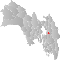
| Location in the province of Viken | ||

|
||
Rælingen is a municipality in the Romerike region in the Norwegian Fylke Viken with 18,530 inhabitants (as of February 27, 2020). The seat of the administration is in Fjerdingby . The parish was founded in 1929 through a spin-off from the parish of Fet and got its name from the Rælingen farm, near which the church from 1828 is also located.
location
Rælingen is located southeast of Oslo . The densely populated northern part of the municipality borders on Strømmen in Lillestrøm municipality and is already counted as part of the settlement area of Oslo. Rælingen borders on Lørenskog to the west and Enebakk to the south . The municipality is bordered to the east by Lake Øyeren . The part of the Øyeren in Rælingen is part of the Nordre Øyeren nature reserve . The western part of the municipality is largely uninhabited forest and moorland and belongs to the Østmarka . The highest point of the Østmarka, the Barlindåsen at 398 meters, is also the highest point in Rælingen.
population
The northern part of the municipality is densely populated and consists of a number of interlinked villages, the largest of which are Strøm , Åmot and the administrative center of Fjerdingby . The rest of the population lives in the villages connected by Fylkesvei 120 ( tettsteder ) Smestad (2,348 inhabitants) and Fjellstad (952 inhabitants). Like most of the communities around the outskirts of Oslo, Rælingen has seen population growth rapidly in recent decades. The population increased from 3,464 in 1955 to 12,187 in 1980 and 18,530 in 2020. However, the growth is less than in many neighboring communities.
Name and coat of arms
The name Rælingen has been used since the early 14th century and probably goes back to the Old Norse rá , which means remote.
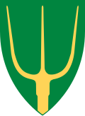
The coat of arms of Rælingen consists of a yellow pitchfork on a green background as an allusion to the agricultural traditions of the municipality and symbolizes the three rivers Nitelva , Leira and Glomma , which flow into the Øyeren in Rælingen.
economy
Rælingen is the largest commuter community in Norway. More than 85% of employees commuted from the municipality in 2019, mainly to Lillestrøm and Oslo. Most of the community's jobs are in the public sector, the service sector, and agriculture. There are also some smaller industrial companies.
Sports
The sports club Rælingen Skiklubb has its own winter sports center, Marikollen Skisenter in Fjerdingby.
Personalities from Rælingen
- Kåre Fuglesang (1921–2000) - violinist and music teacher
- Arnfinn Karlstad (1936-2008) - ski jumper
- Marte Stokstad (born 1978) - TV presenter
- Henrik Kristoffersen (* 1994) - Alpine skier
- Kristoffer Ajer (born 1998) - football player
- Marius Lindvik (* 1998) - ski jumper
Web links
- Rælingen in the store norske leksikon (Norwegian)
Individual evidence
- ↑ Statistisk sentralbyrå - Befolkning
- ↑ Høyeste fjelltopp i hver commune. Kartverket.no, July 8, 2020, accessed on July 29, 2020 .
- ↑ Tettsteders following og areal. Statistisk sentralbyrå , December 20, 2019, accessed July 26, 2020 .
- ↑ Follow. Statistisk sentralbyrå, accessed on July 29, 2020 .
- ↑ Facta om Rælingen. Rælingen Kommune, accessed on July 26, 2020 .
- ^ A b Geir Thorsnæs and Svein Askheim: Rælingen. In: Store Norske Leksikon. July 18, 2020, accessed July 26, 2020 .
- ↑ Dag Aasdalen and Anne Linn Kumano Ensby: Rælingen municipality. NRK.no, June 8, 2007, accessed July 26, 2020 .
- ↑ Sysselsetting. Statistisk sentralbyrå, accessed on July 29, 2020 .
