Øvre Eiker
| coat of arms | map | |
|---|---|---|

|
|
|
| Basic data | ||
| Commune number : | 3048 | |
| Province (county) : | Viken | |
| Administrative headquarters: | Hokksund | |
| Coordinates : | 59 ° 28 ' N , 9 ° 33' E | |
| Surface: | 456.69 km² | |
| Residents: | 19,423 (Feb 27, 2020) | |
| Population density : | 43 inhabitants per km² | |
| Language form : | Bokmål | |
| Website: | ||
| politics | ||
| Mayor : | Knut Kvale ( Senterpartiet ) (2019) | |
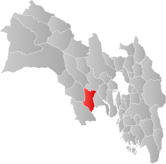
| Location in the province of Viken | ||

|
||
Øvre Eiker is a municipality in the Norwegian Fylke Viken . The municipality has 19,423 inhabitants (as of February 27, 2020). The administrative seat is the town of Hokksund .
geography
The municipality borders on the neighboring municipalities of Drammen , Kongsberg , Sigdal , Modum , Lier , Flesberg and Holmestrand . Together with Nedre Eiker , the municipality is part of the Eiker landscape along the Drammen river . The highest point is the Myrehogget with 706.7 moh.
About half of the municipality's residents live in Hokksund , while the rest live in the small towns of Vestfossen , Skotselv , Ormåsen and Darbu . This means that the majority of the population lives in the lower part of the municipality. As in many municipalities in Viken , the official written language is Bokmål , i.e. the more widespread of the two Norwegian language forms.
history
The municipality of Øvre Eiker was founded on July 1, 1885 after the municipality of Eiker was divided into Nedre Eiker and Øvre Eiker. Nedre Eiker was incorporated into Drammen on January 1, 2020 as part of the local government reform in Norway . At the time it was founded, Øvre Eiker had 7,393 inhabitants. Until December 31, 2019, the municipality belonged to the former province of Buskerud , which became part of the newly created Fylke Viken.
An ironworks was operated in Skotselv between 1649 and 1854. From 1741 to 1777 there was a glass factory in Hokksund. From 1888 to 1978 there was also a cellulose and paper mill in the municipality.
economy
In 2019, 3,625 of 9,709 people worked in Øvre Eiker itself, while many residents worked in the municipalities of Drammen (1,745 people), Nedre Eiker (1057), Kongsberg (939) or Oslo (574).
There are four power plants in Øvre Eiker that generate an average of 122 gigawatt hours per year. The Sørlandsbanen runs through Øvre Eiker and has a stop in Hokksund .
coat of arms
The coat of arms, official since 1981, shows a silver oak branch with three leaves and two acorns on a blue background . It alludes to the name of the commune, since eiker is the plural of eik , i.e. oak .
Attractions
- Fiskum gamle kirke , one of the smallest churches in Norway, built in 1250
Personalities
- Jonas Lie (1833–1908), writer and playwright
- Christopher Hornsrud (1859–1960), politician (Prime Minister)
- Per Olaf Lundteigen (* 1953), farmer and politician
- Arne Nævra (* 1953), nature photographer and politician
Web links
- Øvre Eiker in the store norske leksikon (Norwegian)
Individual evidence
- ↑ Statistisk sentralbyrå - Befolkning
- ↑ Høyeste fjelltopp i hver commune. September 1, 2015, accessed on July 30, 2020 (Norwegian Bokmål).
- ↑ a b c Geir Thorsnæs: Øvre Eiker . In: Store norske leksikon . March 5, 2018 (Norwegian, snl.no [accessed July 30, 2020]).
- ↑ Forskrift om målvedtak i Kommunar og fylkeskommunar (målvedtaksforskrifta). In: Lovdata. January 6, 2020, accessed July 30, 2020 (Norwegian).
- ↑ Pendlingsstrømmer. Statistics Norway, accessed July 30, 2020 (Norwegian).

