Langjokull
| Langjokull | ||
|---|---|---|
|
Satellite image, Langjökull idMi. Left |
||
| location | Iceland | |
| Type | icecap | |
| surface | 953 km² | |
| Altitude range | 1450 m - 400 m | |
| Ice thickness | Max. 580 m | |
| Ice volume | 195 km³ | |
| Coordinates | 64 ° 45 ′ N , 19 ° 59 ′ W | |
|
|
||
| particularities | Two calderas under the glacier | |
|
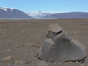
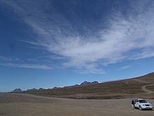
Langjökull and Hvítárvatn from Kjölur |
||
|
Hagavatn with the Eystri-Hagafellsjökull glacier tongue |
||
|
Langjokull |
||

The Langjökull [ 'lauŋkˌjœˑkʏtl˳ ] ( Icelandic for "long glacier") with about 953 square kilometers the second largest glacier of Iceland .
It is located in the western part of the Icelandic highlands . You can see it clearly from Haukadalur , where on cloudy days the horizon line can hardly be distinguished from its ice surface.
Langjokull ice cap
Characteristics
It is the second largest glacier in Iceland . Such larger glaciers are known as ice caps . It is located in the west of the country and in 1989 covered an area of 950 km². In 2006 its area had already shrunk to 925 km².
In the same year it had a volume of 195 km³, the ice layer was up to 580 m thick and he was at heights between 1450 and 400 m .
Significantly, one encounters various data on the height or volume of the glacier in the literature: old measurements were not as accurate as new ones, and glaciers are constantly changing, partly due to general climate change, partly also, for example in Iceland, due to changes in the volcanic activity under the glacier.
The glacier reached its greatest thickness in 1840.
Location and shape
The glacier roughly follows the orientation of the active volcanic zone in Iceland, to which it belongs with at least two active volcanic systems under its cap, and thus extends from southwest to northeast. It shows a narrow point between the lake Hvítárvatn an des Kjalvegurs ![]() and the valley glacier Þrístapajökull , which extends down towards Eiríksjökull to the northwest.
and the valley glacier Þrístapajökull , which extends down towards Eiríksjökull to the northwest.
Several mountains and mountain ranges lie on the edge of the glacier, such as B. the volcanic mountain range Jarlhettur , which can be seen well from above the Gullfoss waterfall . The latter is a palagonite ridge that was created by a crevice erupted during the last ice age. Other volcanic mountains are located under the glacier, with at least two calderas and a table mountain being made out.
The Skríðufell peak is located by the lake Hvítárvatn . Other peaks are Fjallkirkja ( 1177 m ) and Hyrning ( 1320 m ). A hut belonging to the Icelandic Glacier Association ( Jöklarannskóknarfélag ) has been located a little east of Fjallkirkja since 1979 . The mountains Þursaborg ( 1290 m ) and Péturshorn ( 1370 m ) rise approximately to the northwest of Lake Hvítárvatn .
Valley glacier
Numerous side and valley glaciers emanate from Langjökull. The most famous of these is Geitlandsjökull ( 1395 m ), a table mountain covered by a glacier, which is connected to Langjökull and protrudes from it in the southwest.
Further valley glaciers are in the south Vestri-Hagafellsjökull and Eystri-Hagafellsjökull , the mountain Hagafell separates the two from each other, towards Hvítárvatn fall in the east the Suðurjökull and the Norðurjökull , between which the mountain Skríðufell rises.
Research has shown that the valley glaciers Suður- and Norðurjökull slowly advanced into Lake Hvítárvatn and reached their greatest extent around the end of the 19th century, after which they retreated relatively quickly during the 20th century.
Water balance and development of the glacier
In relation to its size, few rivers flow from Langjökull. On the other hand, it has been researched that large amounts of water feed the lake Þingvallavatn underground and via the Arnarvatnsheiði the Hvítá and other rivers of the Borgarfjörður . The water, before it reached it as drinking water, had been on the move for about 1000 years since it fell on the glacier as precipitation.
The hot water of the springs in Borgarfjörður v. a. in Reykholtsdalur , for example Deildartunguhver , partly comes from a detour and is heated on the spot by geothermal energy.
Due to the lack of detectable sediments, research suggests that around 2/3 of the water flowing from Langjökull into Lake Hvítárvatn is groundwater.
It is now assumed that if the climate changes continue to develop in the same direction as before, the Langjökull glacier will have completely disappeared in about 150 years (see also: Glacier retreat ).
Volcanism
The Langjökull ice sheet is located on the WRZ (Western Rift Zone) of Iceland and thus in the area of active volcanism.
At least two volcanic systems are partially under this glacier, one in the northeast and another in the southwest. The southwest has its central volcano in Prestahnúkur , other scientists also speak of the Geitland volcanic system , the other belongs to Hveravellir . The calderas are clearly visible on aerial photographs.
Northwestern volcanic system
The best known of these volcanic systems is that of Hveravellir, which is sometimes also called the Langjökull system , it is also known as the Baldjökull system . Under the glacier lies a plateau with a large shield volcano and a table mountain .
The volcanic system has dimensions of approx. 55 km in length and 5-18 km in width.
During the warm periods of the Ice Age, the volcanic system u. a. create some shield volcanoes in the east of today's glacier, which in turn u. a. 7,800 years ago created the Kjalhraun lava field , over which the Kjölur highland slope runs. The high temperature area of Hveravellir belongs to this volcanic system. Many researchers also suspect that the central volcano is here.
Craters in the west of the glacier on today's Arnarvatnsheiði north of Eiríksjökull gave rise to the 50 km long Hallmundarhraun lava field around 1,000 years ago , which extends far down into Hvítárdalur and in which the Hraunfossar waterfalls are located. It also contains the longest, so far discovered lava caves in the country, cf. Surtshellir .
Prestahnúkur and Geitlandsjökull volcanic system
In the south-west, on the other hand, lies the Prestahnúkur system, whose crevices also extend below Geitlandsjökull and Langjökull.
This volcanic system measures approx. 70 km in length and 5–17 km in width.
There is also a high temperature area at Prestahnúkur.
Volcanic activity in the Holocene
Overall, however, it is a relatively quiet region from a volcanic point of view with only about 32 eruptions in the last 10,000 years, i.e. H. after the Ice Age , which lasted longer in Iceland than in mainland Europe.
4–5 shield volcanoes and 5 eruptive fissures were active after the Ice Age, most recently the fissures and craters in Hallmundarhraun in the 9th century.
Basalts from the Tholeitic series are to be mentioned as eruptive products . Rhyolite was also exposed, especially in the central volcanoes .
Current developments in spring 2011
In the winter of 2011, members of the rescue companies from the nearby town of Borgarnes discovered that the Langjökull glacier had many more crevasses than before and that it had therefore become quite dangerous to navigate it as before.
When asked about the reasons for this development, the Icelandic geophysicist Helgi Björnsson stated that on the one hand it was due to climate change. The glaciers in Iceland are currently losing about 1 m in thickness over the surface every year. If the climate changes continued like this or even intensified, Langjökull might not be there in 150 years. On the other hand, the eruption of Eyjafjallajökull in 2010 had an impact that should not be underestimated. The ash that was spread over Langjökull melted it so much that the mass of snow that had accumulated in 2-3 years disappeared. Glaciers are formed by the accumulation of snow.
Highland slopes
An access to Langjökull exists z. B. also via the Kaldidalur highland slope. The highland slope Kjalvegur ![]() runs between it and Hofsjökull .
runs between it and Hofsjökull .
See also
- Iceland glaciers
- Volcanoes in Iceland
- Geography of Iceland
- List of mountains and elevations in Iceland
Web links
Photos
Scientific contributions to the glacier
- Gwenn E. Flowers, Helgi Björnsson, Áslaug Geirsdóttir, Gifford H. Miller, Garry KCClarke: Glacier fluctuation and inferred climatology of Langjokull through the little Ice Age. In: Quaterny Science Reviews, Vol. 26, 2007 (English) [Climate changes and their influence on the glacier]. Gwenn E. Flowers, Helgi Björnsson, Áslaug Geirsdóttir, Gifford H. Miller and Garry KCClarke: Glacier fluctuation and inferred climatology of Langjokull through the little Ice Age. In: Quaterny Science Reviews , Vol. 26, 2007, doi: 10.1016 / j.quascirev.2007.12.004 (English) [Climate changes and their influence on the glacier]
- Sverrir Guðmundsson, Helgi Björnsson et al .: Áhrif loftslagsbreytingar á stærð of afrennsli Langjökuls, Hofsjökuls og suður Vatnajökuls. (PDF) Orkuþing 2006 (Icelandic)
- Gwenn E. Flowers, Helgi Björnsson et al .: Holocene climate conditions and glacier variation in central Iceland from physical modeling and empirical evidence. Quaternary Science Reviews, Vol.27, Issues 7-8, Ap. 2008 (Holocene developments at Langjökull) doi: 10.1016 / j.quascirev.2007.07.016
- Helgi Björnsson et al .: Geometry, mass balance and climate change response of Langjökull icecap, Iceland. (PDF) Geolog. Inst., Univ. Iceland on climatic influences on Langjökull
To volcanism
- Hveravellir in the Global Volcanism Program of the Smithsonian Institution (English)
- Earthquake monitoring at Langjökull. (English)
- Sveinn Jakobson et al .: Volcanic systems and segmentation of the plate boundaries in SW-Iceland . (PDF; 74 kB)
Sporty
Individual evidence
- ↑ T. Einarsson, H. Magnússon (Eds.): Íslandshandbókin. Náttura, saga and sérkenni. Fyrra bindi . Reykjavík 1989, p. 111 f.
- ↑ a b c Gwenn E. Flowers, Helgi Björnsson, Áslaug Geirsdóttir, Gifford H. Miller and Garry KC Clark: Glacier fluctuation and inferred climatology of Langjokull through the little Ice Age. in: Quaterny Science Reviews, Vol. 26, 2007 doi: 10.1016 / j.quascirev.2007.07.016
- ↑ Áhrif loftslagsbreytingar á stærð and afrennsli Langjökuls, Hofsjökuls and suður Vatnajökuls . ( Memento of the original from November 8, 2012 in the Internet Archive ) Info: The archive link was inserted automatically and has not yet been checked. Please check the original and archive link according to the instructions and then remove this notice. (PDF) Orkuþing, 2006 (Icelandic) Retrieved February 12, 2010.
- ↑ Kortabók . Mál og Menningar, Reykjavík 2005, pp. 48/49 and 55/56.
- ↑ a b c d e Ari Trausti Guðmundsson: Living Earth. Facets of the geology of Iceland. Mál og Menning, Reykjavík 2007, p. 193
- ^ Global Volcanism Program. Smithsonian Inst. (English); accessed June 20, 2011
- ↑ Sveinn Jakobson u. a .: Volcanic systems and segmentation of the plate boundaries in SW-Iceland . (PDF; 74 kB) mantleplumes.org (English)
- ↑ cf. Literature list, web links
- ↑ dagskra.ruv.is broadcast Landinn , interviews u. a. with Björn Björnsson (rescue company Björgunarsveit Borgarnesi) and Helgi Björnsson (geophysicist), Staatl. isl. Television companies ( RÚV ), February 27, 2011 (Icelandic); Retrieved March 3, 2011


