Hunt bluff
| Hunt bluff | ||
|---|---|---|
| location | Marie Byrd Land , West Antarctica | |
|
|
||
| Coordinates | 74 ° 36 ′ S , 111 ° 52 ′ W | |
|
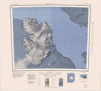
Bear Peninsula map with Hunt Bluff (left) |
||
The Hunt Bluff is a steep, 5 km long rocky cliff at the Walgreen Coast of the West Antarctic Marie Byrd lands . It rises 3 km south of Jeffery Head on the west side of the Bear Peninsula and borders directly on the Dotson Ice Shelf .
The first aerial photographs were taken during the US operation Highjump (1946–1947). The Advisory Committee on Antarctic Names named it in 1967 after Lieutenant Robert Bridger Hunt (1940-2004) of the United States Navy Reserve , medical officer at Byrd Station in the Antarctic winter of 1966.
Web links
- Hunt Bluff in the Geographic Names Information System of the United States Geological Survey (English)
- Hunt Bluff on geographic.org

