Ibex Valley
| Ibex Valley | ||
|---|---|---|
 Alaska Highway |
||
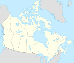
| Location in Yukon | ||
|
|
||
| State : |
|
|
| Territory : | Yukon | |
| Coordinates : | 60 ° 51 ′ N , 135 ° 38 ′ W | |
| Area : | 209.06 km² | |
| Residents : | 411 (as of 2015) | |
| Population density : | 2 inhabitants / km² | |
Ibex Valley is a self-governing hamlet in the Canadian Yukon (incorporated hamlet).
The Ibex Valley includes groups of houses in the area of the Alaska Highway (about mile 945), as well as houses on an approximately 5 km long circular route between miles 929 and 934. The river that gives it its name is the Ibex River . The place belongs to the agglomeration of Whitehorse and is located around 16 km southeast of the city center. It is also in the traditional territory of the Ta'an Kwach'an First Nation , just as the entire city of Whitehorse is in its territory and in the territory of the Kwanlin Dun First Nation .
The majority of the residents work in Whitehorse and commute there, but there is also limited agriculture and tourism in the town; the latter focuses on agrotourism and so-called wilderness tourism .
Five councils ( councilors ) are the local government.
Demographics
The census in 2016 showed a population of 411 inhabitants for the municipality, after the census in 2011 showed a population of 346 inhabitants for the municipality. The population has increased significantly by 18.8% compared to the last census in 2011 and is thus far above the average of the territory with a population increase of 5.8%.
In 2001 Ibex Valley had 315 inhabitants, in 2006 already 376. They lived in 160 households. 90 residents said they were indigenous people .
Web links
Remarks
- ↑ Ibex Valley Community Profile. Census 2016. In: Statistics Canada . August 9, 2019, accessed April 20, 2020 .
- ^ Statistics Canada, Ibex Valley
