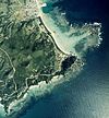
Iheya Izena Islands
| Iheya Izena Islands | ||
|---|---|---|
| Waters | East China Sea | |
| archipelago | Okinawa Islands | |
| Geographical location | 27 ° 0 ' N , 127 ° 57' E | |
|
|
||
| Number of islands | 10 (≥ 1 ha) | |
| Main island | Iheya-jima and Izena-jima | |
| Total land area | 37 km² | |
| Residents | 2578 (October 1, 2019) | |
The Iheya-Izena Islands ( Japanese 伊 平 屋 伊 是 名 諸島 , Iheya-Izena-shotō ) are a group of islands in the Japanese prefecture of Okinawa in the East China Sea .
geography
The Iheya Izena Islands are 20 km north of the Motobu Peninsula of Okinawa . With the exception of the lonely island of Iōtorishima , they form the northern part of the Okinawa Islands .
The group consists of the two main islands Iheya-jima and Izena-jima , the islands Noho-jima , Yanaha-jima, Gushikawa-jima and Urugami-shima as well as other rocks and unnamed islets. Before a landfill that connected Yanoshita-jima with Izena-jima, the group consisted of seven larger islands and was also called Iheya no Shichi Banare ( 伊 平 屋 の 七 離 れ , "seven parts of Iheya"). The islands are surrounded by coral reefs or coral reefs themselves.
Islands
The archipelago consists of the following islands with an area of at least one hectare:
| Aerial view | Surname | Japanese | Area [km²] | Height [m] | local community | Coordinates |
|---|---|---|---|---|---|---|

|
Iheya-jima | 伊 平 屋 島 | 20.66 | 293.9 | Iheya | 27 ° 3 ' N , 127 ° 59' E |

|
Izena-jima | 伊 是 名 島 | 14.12 | 119.9 | Izena | 26 ° 56 ′ 2 ″ N , 127 ° 56 ′ 11 ″ E |

|
Noho-jima | 野 甫 島 | 1.08 | 43 | Iheya | 26 ° 59 ′ 41 ″ N , 127 ° 55 ′ 13 ″ E |

|
Yanaha-jima | 屋 那覇 島 | 0.74 | 12.5 | Izena | 26 ° 53 '50 " N , 127 ° 55' 35" E |

|
Gushikawa-shima | 具 志 川島 | 0.47 | 28 | Izena | 26 ° 58 ′ 31 ″ N , 127 ° 57 ′ 4 ″ E |

|
Urugami-jima | 降 神 島 | 0.01 | 20th | Izena | 26 ° 55 ′ 8 " N , 127 ° 57 ′ 28" E |
| Yāhe-iwa | ヤ ー ヘ 岩 | 0.01 | 47 | Iheya | 27 ° 5 ′ 28 " N , 127 ° 59 ′ 44" E | |
| unnamed | 0.01 | 10 | Iheya | 27 ° 0 ′ 8.5 " N , 127 ° 55 ′ 28" E | ||
| unnamed | 0.01 | 17th | Iheya | 26 ° 59 ′ 36 " N , 127 ° 54 ′ 45" E | ||
| unnamed | 0.01 | ? | Iheya | 26 ° 59 ′ 40 " N , 127 ° 54 ′ 41" E | ||

|
Yanoshita-jima (today peninsula) |
屋 ノ 下 島 | 0.2 | 7th | Izena | 26 ° 56 ′ 12 " N , 127 ° 54 ′ 56" E |
|
|
||||||
Individual evidence
- ↑ a b 伊 平 屋 伊 是 名 諸島 . In: 世界 大 百科 事 典 第 2 版 at kotobank.jp. 2012, Retrieved December 2, 2012 (Japanese).
- ↑ 歴 史 . In: 伊 平 屋村 ホ ー ム ペ ー ジ - て る し の NET. Iheya, accessed December 4, 2012 (Japanese).
- ↑ 指定 離島 ・ 指定 離島 一 覧 . (PDF) In: 離島 関係 資料 (平 成 28 年 1 月) . 沖 縄 県 企 画 部 地域 ・ 離島 課 ("Land and Islands Unit, Planning Department, Okinawa Prefecture"), January 2016, p. 1 , accessed on 3. August 2016 (Japanese).
- ↑ presumed assignment: Listed in the source as シ マ (野 甫 島 北) 'island (north of Noho-jima)'. On the official maps there is an unnamed island with the specified area at these coordinates.
- ↑ presumed assignment: Listed in the source as シ マ (野 甫 島 西 1) 'island (west of Noho-jima (1))'. On the official maps there is an unnamed island with the specified area at these coordinates.
- ↑ presumed assignment: Listed in the source as シ マ (野 甫 島 西 2) 'island (west of Noho-jima (2))'. On the official maps there is an unnamed island with the specified area at these coordinates.
- ↑ Not listed in the source as the island no longer exists today. The area was measured.
