Ilhéu de Cima (Madeira)
| Ilheu de Cima | ||
|---|---|---|
| Ilhéu de Cima as seen from Porto Santo | ||
| Waters | Atlantic Ocean | |
| Archipelago | Madeira | |
| Geographical location | 33 ° 3 '17 " N , 16 ° 16' 55" W | |
|
|
||
| length | 1.2 km | |
| width | 500 m | |
| surface | 32 ha | |
| Highest elevation | 111 m | |
| Residents | uninhabited | |
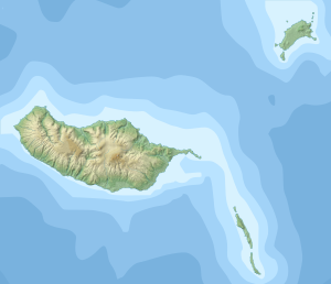
| Map of Porto Santo, Ilhéu de Cima to the east | ||
Ilhéu de Cima is a small, uninhabited island in the Portuguese autonomous region of Madeira .
geography
The island is about one kilometer east of the island of Porto Santo, which belongs to the Madeira archipelago . The elongated island is about 1.2 km long in east-west direction, up to 500 m wide and reaches a height of 111 m above sea level. With an area of 32 ha (0.32 km²), it is the second largest of the islands off Porto Santo, the so-called Ilhéus do Porto Santo, after the Ilhéu da Cal . Like all of these islands, Ilhéu de Cima is a Natura 2000 reserve. In the east of the island is the Farol do Ilhéu de Cima lighthouse, built in 1900 and 15 m high .
Web links
- About the fauna of the islands off Porto Santo (port .; PDF)
Individual evidence
- ↑ The Portuguese Natura 2000 sites (map and list; PDF; 2.7 MB)
- ↑ FARÓIS de PORTUGAL ( Memento of the original from June 26, 2010 in the Internet Archive ) Info: The archive link has been inserted automatically and has not yet been checked. Please check the original and archive link according to the instructions and then remove this notice. (port.)


