Illorsuit (island)
| Illorsuit | ||
|---|---|---|
| The southern part of Illorsuit Island | ||
| Waters | Karrat Fjord , Baffin Bay , Atlantic Ocean | |
| Geographical location | 71 ° 10 ′ N , 53 ° 43 ′ W | |
|
|
||
| surface | 468 km² | |
| Residents | 7th <1 inh / km² |
|
| main place | Illorsuit | |
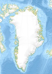
| Location of Illorsuit | ||
Illorsuit (according to the old spelling Igdlorssuit , German large houses ; Danish Ubekendt Ejland ) is an island in the district of Uummannaq in Avannaata Kommunia , Greenland .
geography
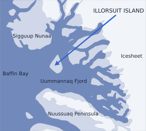
Illorsuit is the second largest island in the Karrat Fjord system . It is located in the east of the estuary between the Sigguup Nunaa peninsulas (in the north) and Nuussuaq (in the south). The island is shaped like a pear .
Settlements
Illorsuit is the only settlement on the island. It is located in the northeast of the island and is currently abandoned. The reason is a tsunami that was triggered by a landslide in northwest Greenland in 2017 and hit the island. The settlement has since been evacuated.
Individual evidence
- ↑ Nuussuaq , Saga Map, Tage Schjøtt, 1992
- ↑ Christoph Seidler: Landslide and huge tidal wave on Greenland: The 95-meter tsunami. Mirror online. August 17, 2017. Retrieved November 6, 2018.


