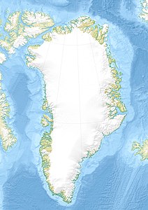
Illunnguit
| Illunnguit | ||
|---|---|---|
| Waters | Tasiusaq Bay , Baffin Bay , Atlantic Ocean | |
| Archipelago | Upernavik archipelago | |
| Geographical location | 73 ° 18 ′ 0 ″ N , 56 ° 20 ′ 0 ″ W | |
|
|
||
| length | 5.4 km | |
| width | 5.8 km | |
| surface | 19 km² | |
| Highest elevation | 310 m | |
| Residents | uninhabited | |
Illunnguit (after old spelling Igdlúnguit , German small houses ) is an uninhabited island in the district of Upernavik in the Avannaata Kommunia , Greenland . It is located south of Innaarsuit .
The island belongs to the Upernavik archipelago .
Illunnguit was once inhabited.
geography
The island is located on the outer edge of Tasiusaq Bay in the central part of the Upernavik Archipelago . The bay's waterways divide the island from Paagussat to the north and Tasiusaq to the east.
The highest point is an unnamed point with a height of 310 meters in the southeast.
climate
The warmest month is July, the average temperature during this time is 8 ° C and the coldest month is February with -25 ° C.
Individual evidence
- ^ Upernavik , Saga Map, Tage Schjøtt, 1992
- ^ Robert Petersen: Settlements, kinship and hunting grounds in traditional Greenland: A comparative study of local experiences from Upernavik and Ammassalik . Danish Polar Center, 2003, ISBN 978-87-635-1261-9 , p. 130.
