Indian Brook (Halls Bay)
| Indian Brook | ||
|
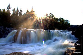
Indian Falls at Springdale |
||
| Data | ||
| location | Newfoundland in Newfoundland and Labrador ( Canada ) | |
| River system | Indian Brook | |
| Headwaters | east of Bar Pond 49 ° 24 ′ 8 ″ N , 56 ° 49 ′ 12 ″ W |
|
| Source height | approx. 300 m | |
| muzzle |
Hall's Bay ( Labrador Sea ) coordinates: 49 ° 28 ′ 57 " N , 56 ° 4 ′ 11" W 49 ° 28 ′ 57 " N , 56 ° 4 ′ 11" W |
|
| Mouth height | 0 m | |
| Height difference | approx. 300 m | |
| Bottom slope | approx. 3.5 ‰ | |
| length | approx. 85 km | |
| Catchment area | approx. 1200 km² | |
| Discharge at the Indian Falls A Eo gauge : 974 km² Location: 6 km above the mouth |
MQ 1955/1995 Mq 1955/1995 |
19.4 m³ / s 19.9 l / (s km²) |
| Left tributaries | Black Brook, Davis Brook | |
| Right tributaries | Burnt Berry Brook | |
| Flowing lakes | Lake Buck, Indian Pond | |
| Communities | Springdale | |
| Discharge of river water to Birchy Lake | ||
The Indian Brook is an approximately 85 km long tributary of Halls Bay in the northwest of the island of Newfoundland, which belongs to the Canadian province of Newfoundland and Labrador .
River course
Indian Brook rises east of Barren Pond at an altitude of about 300 m . In its headwaters there are two nameless lakes that it flows through. From these it flows mainly in an easterly direction to Lake Buck . The outflows of the lakes Upper Indian Pond and Gillards Lake to the north flow into the Indian Brook a little later on the left. At river kilometer 58 there is a dam ( ⊙ ). South of this, a 1.5 km long drainage channel leads a large part of the river water to Birchy Lake , which belongs to the lake system of Grand Lake , which is used there for hydropower by the Deer Lake hydropower station . Below the dam, the Trans-Canada Highway runs for 35 km along the right bank of the river. The Indian Brook flows through the Indian Pond , into which the Black Brook coming from the west flows. The route 390 , which branches off from the Trans-Canada Highway, cross flow at the Indian Brook 12.5 kilometers and then runs along the left bank of the Indian Brook until after Springdale . The Indian Falls rapids are located about 6 kilometers above the mouth of the river. The Indian Brook takes on the Burnt Berry Brook to the right and the Davis Brook from the left , before finally flowing south of the municipality of Springdale into the west bank of Halls Bay, a 36 km deep bay on the north coast of Newfoundland.
![]() Map with all coordinates: OSM | WikiMap
Map with all coordinates: OSM | WikiMap
Hydrology
The catchment area of Indian Brook covers an area of about 1200 km². The mean discharge at the gauge above Indian Falls is 19.4 m³ / s. In May, the river carries the largest amount of water at the level with an average of 64.3 m³ / s. Most of the river water from the 238 km² catchment area of the upper reaches is diverted to Birchy Lake . The mean discharge in the drainage channel is 6.5 m³ / s.
Fish fauna
Atlantic salmon are found in Indian Brook . Its existence in the river system is considered "not endangered".
Web links
- Indian Brook at Natural Resources Canada
Individual evidence
- ^ A b c Government of Canada: Historical Hydrometric Data Search Results: Station 02YM001
- ^ Government of Canada: Historical Hydrometric Data Search Results: Station 02YM004
- ↑ NASCO Rivers Database Report (PDF, 1.4 MB) North Atlantic Salmon Conservation Organization (NASCO). Retrieved November 22, 2018.
