Inishbofin (Galway)
| Inishbofin | ||
|---|---|---|
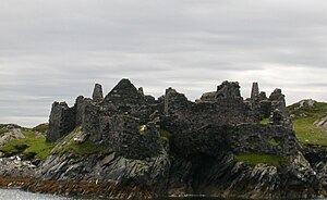
| Cromwell's Fort | ||
| Waters | Atlantic Ocean | |
| Geographical location | 53 ° 37 '10 " N , 10 ° 12' 26" W | |
|
|
||
| length | 7.1 km | |
| width | 3.8 km | |
| surface | 9.61 km² | |
| Highest elevation | 89 m | |
| Residents | 160 (2011) 17 inhabitants / km² |
|
| main place | Inishbofin | |
| Lough Bofin in the west of the island | ||
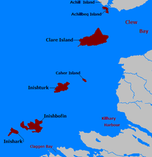
Inishbofin ( Irish Inis Bó Finne - "Island of the White Cow") is a small island 9 km off the west coast of the Republic of Ireland in County Galway . The 15 km² large, indented island lies in front of Connemara north of the city of Clifden . It reaches a height of 85 meters in the west and has two other almost equally high peaks. There is a ferry connection to the island from the small town of Cleggan . 199 people still live on the island (as of 2006), who live mainly from fishing and agriculture. In winter, storms sometimes cut the island off from the mainland for weeks.
history
Among the archaeological sites on the island include: The Promontory Fort Cloonamore and West Quarter 1 and 2, a plurality Castle ruins, a Cillin , destroyed Cromwell -Baracken, an earthwork , an indeterminable and early church fence , a field system at Middle Quarter, a ruined house, two Saints Quellen , a horizontal mill , two Kökkenmöddinger , four Promontory forts and more than half a dozen round huts .
According to Beda Venerabilis (d. 735), St. Colman (605–675), the Irish bishop of Northumbria , came to Inishbofin as a pensioner after the Synod of Whitby , where he resigned because the Catholic rite was introduced, where he received 665 Founded monastery. The annals of the four masters record his various abbots up to the year 918.
The island initially belonged to the O'Flaherty clan until they won the O'Malleys in 1380. She is associated with the pirate Grace O'Malley (1530-1603) and the Spanish pirate Alonzo Bosco, who fortified the port.
Before 1609, Inishbofin belonged to the Earl of Clanrickard like many other lands of dissolved monasteries. During the Irish rebellion of 1641-52 Inishbofin was an important base for the supply of arms to the royalists by the Duke of Lorraine (Lorraine). When Galway and the Aran Islands were captured by Cromwell's people in 1652 , a force from Inishbofin retook one of the Aran forts. At the beginning of 1653, Inishbofin was threatened by bombardment by ships and was surrendered. It later became a prison camp for Catholic priests who were arrested by Cromwell's people. The fort at the harbor was a Jacobite garrison in 1690 , but it was handed over to King William People in 1691. Around 1830 Inishbofin passed from the Clanrickards to the Brownes of Westport . Lord Sligo, an heir of the family, sold it to Henry William Wilberforce in 1855. In 1876 it was bought by Cyril Allies, a Catholic Englishman, and the Land Commission eventually bought it from him. The island is divided into five peasant communities.
flora
Grasses, irises, swamp thistles, red clover and moss cover Inishbofin and thyme grows everywhere. The first people came to the island more than 6000 years ago. "Island of the white cow" means that a witch is said to have turned a cow into stone here, according to legend.
Legend
Legend has it that the island was a tidal island when fishermen landed in the fog and brought fire to the island. As the fog cleared, they saw an old woman leading a white cow that turned into a rock when she hit her. The cow occasionally visits Loch Bó Finne, the lake of the white cow.
Web links
Individual evidence
- ↑ Table No. 11 Population of inhabited Islands off the coast, 2006 and 2011 . In: Central Statistics Office (Ed.): Population Classified by area . Dublin 2012, pp. 132-133 ( PDF file; 3.64 MB ( memento of October 10, 2012 in the Internet Archive ))
- ↑ PDF at msi.nga.mil


