Isla Fuerte
| Isla Fuerte | ||
|---|---|---|
| Puerto Limón on the southeast coast | ||
| Waters | Golfo de Morrosquillo, Caribbean Sea | |
| Geographical location | 9 ° 23 '20 " N , 76 ° 10' 45" W | |
|
|
||
| length | 2.45 km | |
| width | 1.45 km | |
| surface | 3.25 km² | |
| Highest elevation | 12 m | |
| Residents | 2500 (March 18, 2012) 769 inhabitants / km² |
|
| main place | Puerto Limón | |
| Map sketch | ||
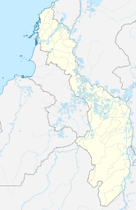
The island of Isla Fuerte is part of the Colombian department of Bolívar near Cartagena and is located around 11 km off the coast of the department of Córdoba in the Caribbean Sea . On March 18, 2012 a population of 2,500 was reported, another source names 4,000 inhabitants. The island has an area of 325 hectares . With a maximum height of twelve meters, it is flat. The only place on the island is Puerto Limón on the southeast coast. Isla Fuerte belongs to the municipality of Cartagena de Indias .
The inhabitants of the island, mainly of African descent, live 50% from tourism, 30% from fishing and 20% from self-cultivation. Fuerte is considered a tourist destination among divers as it is surrounded by coral reefs .
Web links
- Island tourism website
Individual evidence
- ^ El Espectador March 18, 2012: La isla perdida de Colombia
- ↑ a b Definitely Colombia: Isla Fuerte, hotels, restaurants, tours, map, tourist attractions ( Memento of the original from September 20, 2016 in the Internet Archive ) Info: The archive link was inserted automatically and has not yet been checked. Please check the original and archive link according to the instructions and then remove this notice.


