Isola dell'Unione
| Isola dell'Unione | ||
|---|---|---|
| Waters | Venice lagoon | |
| Geographical location | 45 ° 12 '59 " N , 12 ° 17' 7" E | |
|
|
||
| surface | 6.89 ha | |
| Residents | uninhabited | |
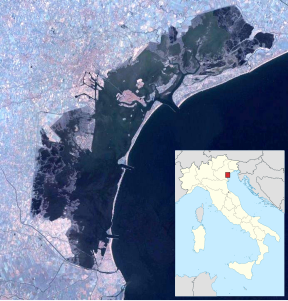
The Isola dell'Unione , often simply Dell'Unione , is an island in the southern lagoon of Venice . It has an area of 6.89 hectares and is located east of Chioggia and the island of Cantieri . A connecting road from Chioggia, with a 700 m long bridge called Ponte Traslagunare, leads across the northern edge of the island of dell'Unione to Sottomarina and from there southwards to the mainland. A footpath leads along the southern edge of the island, the Passeggiata del Lusenzo , where Lusenzo refers to the canal that runs along it. There are various sports facilities on the island.
history
The island was laid out by the unemployed during the 1930s on the initiative of the communist Gino Schiavon from Chioggia in order to gain land on the bridge. He tried to get to Spain in 1936, first went to Czechoslovakia , but was captured near Innsbruck .
Remarks
- ↑ Venice Islands ( memento of March 24, 2009 in the Internet Archive ), archive.org, March 24, 2009.
- ↑ Gianni Scarpa and Sergio Ravagnan: Chioggia nel '900 tra fascismo e democrazia. Fatti, documenti e testimonianze per una storia locale , Centro editoriale Veneto, 1986, p. 125.
- ↑ Rivista storica dell'anarchismo 10 (2003), p. 99, note 7.
