Janhukut
| Janhukut | ||
|---|---|---|
|
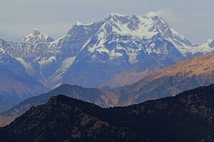
View from the south; the Janhukut is on the left in the picture, in front of it the Chaukhamba massif |
||
| height | 6805 m | |
| location | Uttarakhand ( India ) | |
| Mountains | Gangotri Group ( Garhwal Himalaya ) | |
| Dominance | 5.65 km → Chaukhamba | |
| Notch height | 765 m | |
| Coordinates | 30 ° 46 '42 " N , 79 ° 14' 27" E | |
|
|
||
The Janhukut is a 6805 m high mountain in the Himalayas in Uttarakhand ( India ).
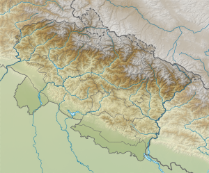
The mountain is located in the Gangotri Group in the eastern Garhwal Himalayas . The Gangotrigletscher flows on its southern flank in a north-westerly direction. Bhagirath Kharak Glacier stretches along the northeast flank of the mountain. A 6040 m high saddle separates the Janhukut from Chaukhamba ( 7138 m ), 5.65 km southeast . Another mountain ridge leads to Satopanth ( 7075 m ), just under 8 kilometers to the north .
In June 2002 the Austrians Josef Jöchler and Christian Zenz tried in vain to climb the mountain for the first time.
Web links
Commons : Janhukut - collection of images, videos and audio files
Individual evidence
- ↑ Asia, India, Central Garhwal — Gangotri, Januhut, Attempt . American Alpine Club. 2003. Retrieved June 17, 2017.

