Ekaterina Street
| Ekaterina Street | ||
|---|---|---|
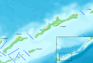
| Card with Russian names. In the center of the picture is Ekaterina Street, southwest of Kunashir, northeast of Iturup. | ||
| Connects waters | Sea of Okhotsk | |
| with water | Pacific Ocean | |
| Separates land mass | Kunashir | |
| of land mass | Iturup | |
| Data | ||
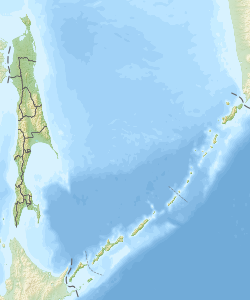
| Geographical location | 44 ° 26 ' N , 146 ° 43' E | |
|
|
||
| Smallest width | 22 km | |
| Greatest depth | 500 m | |
The Yekaterina Strait ( Russian пролив Екатерины ; proliw Jekateriny ) is a sea strait between the Kuril islands of Kunashir in the southwest and Iturup in the northeast, which belong to Russia and are claimed by Japan . It connects the Sea of Okhotsk in the west with the Pacific Ocean in the east. The strait is 22 km wide and between 150 and 500 m deep. Between February and March, drift ice from the northern part of the Sea of Okhotsk reaches the strait, but unlike the more northerly thoroughfares it remains ice-free and is therefore of strategic importance for the Russian Pacific Fleet.
The road bears the name of the Russian ship Yekaterina , which was under way on a trade mission near Japan in 1792 under the leadership of Adam Laksman .
literature
- G. Gilbo: Sprawotschnik po istorii geografitscheskich naswani na pobereschje SSSR . Ministerstwo oborony Soiusa SSR, Glaw. upr. nawigazii i okeanografii, 1985, p. 107. (Russian)
Web links
- Article Ekaterina Street in the Great Soviet Encyclopedia (BSE) , 3rd edition 1969–1978 (Russian)

