Jutiapa (Guatemala)
| Jutiapa | ||
|---|---|---|
|
Coordinates: 14 ° 17 ′ N , 89 ° 54 ′ W Jutiapa on the map of Guatemala
|
||
| Basic data | ||
| Country | Guatemala | |
| Department | Jutiapa | |
| Residents | 162,312 | |
| City insignia | ||
| Detailed data | ||
| surface | 620 km 2 | |
| Population density | 262 inhabitants / km 2 | |
| height | 895 m | |
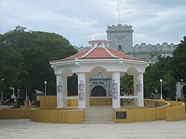
| Park in Jutiapa | ||
Jutiapa is a city in Guatemala and the administrative seat of the Jutiapa Department and the 620 km² large municipality of the same name .
Location and climate
The city is located about 124 km southeast of Guatemala City on the southern foothills of the central highlands at an altitude of 892 m. Jutiapa can be reached from Guatemala City on the CA 1 highway . The climate is hot.
Economy and tourism
A wide variety of agricultural products are produced in and around Jutiapa, including coffee , rice , corn and beans . Livestock and the production of milk and cheese products are of paramount importance . The craft concentrates on products made from ceramics and palm branches as well as leather goods. Jutiapa is the trading center for the named products. The city benefits from its convenient location on the Panamericana and its proximity to El Salvador . The Tourism plays only a minor role. The headquarters of the 3rd Brigada de Infantería “General Manuel Maximiliano Aguilar Santa Maria” of the Guatemalan Army is located in the city .
history
Jutiapa has been the capital of the department of the same name since 1852 .


