Kai Hai Islands
| Kai Hai Islands | ||
|---|---|---|
|
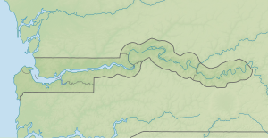
NASA World Wind satellite image The Gambia flows in this image section in a westerly direction. |
||
| Waters | Gambia (river) | |
| Geographical location | 13 ° 33 ' N , 14 ° 53' W | |
|
|
||
| Number of islands | 3 | |
| Total land area | 10 km² | |
| Residents | uninhabited | |
The Kai Hai Islands (other spelling Kai-ai Islands or Kajakat Island ) are a group of islands in the Gambia River in the West African state of Gambia .
geography
The Kai Hai Islands are approximately fourteen kilometers downstream from Janjanbureh Island and fifteen kilometers off the Baboon Islands . The largest, flat, inland island consisting of alluvial land is six kilometers long and one and a half kilometers wide. The profile of the second largest island adjoins the large one, only a narrow canal measuring about fifteen meters separates the two. It is 1,800 meters long and 500 meters wide. A third smaller island is 265 meters long and about 72 meters wide and is located about 26 meters in front of the large island on the northern side.
On the left river island there is a canal about 80 meters wide. The Gambia flows past this group of islands on the right-hand side, about 190 meters wide and three to five meters deep.
Nearby, downriver, is the small island of Miniang Island, 90 meters away . Sapu Island is 150 meters further upriver before the Kai Hai Islands .
The islands, located near the town of Brikama Ba , are not inhabited and a small part is used for agriculture, for example for growing rice . Numerous species of birds can be found on the archipelago.
See also
literature
- Stephen C. Stringall, Dody Broyles: Gambia. International Travel Maps, Vancouver 2003, ISBN 1-55341-217-6 (map, 96 × 61 cm, 1: 350,000)
Web links
- Islands of the Central River Division http://www.birdlife.org
- Gambianbirds.com

