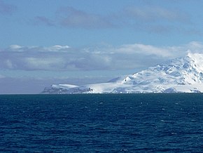
Cape James
| Cape James | ||
 Cape James (left) |
||
| Geographical location | ||
|
|
||
| Coordinates | 63 ° 5 ′ S , 62 ° 42 ′ W | |
| location | Smith Island , South Shetland Islands | |
| Waters | Drake Street | |
| Waters 2 | Bransfield Street | |
 Map of Smith Island with Cape James (below) |
||
Cape James is a cape that forms the southern tip of Smith Island in the archipelago of the South Shetland Islands .
The name of the cape is found in maps based on the work of British polar traveler Henry Foster between 1828 and 1831. Foster named it after the British navigator James Weddell (1787–1834). The Van Rocks lie at a distance of three to five kilometers west of the cape .
Web links
- Cape James in the Geographic Names Information System of the United States Geological Survey (English)
- Cape James on geographic.org (English)
