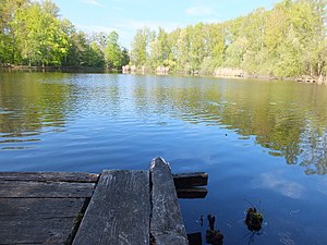
Crucian carp pond
| Crucian carp pond | ||
|---|---|---|

|
||
| Geographical location | Erftstadt , Rhein-Erft-Kreis , North Rhine-Westphalia , Germany | |
| Drain | none | |
| Data | ||
| Coordinates | 50 ° 49 '17 " N , 6 ° 50' 16" E | |
|
|
||
| surface | 1.3 ha | |
| Maximum depth | 2.4 m | |
The Karauschenweiher in Erftstadt is a small lake, next to the Liblarer See , in the Rhein-Erft-Kreis in the southwest of North Rhine-Westphalia .
location
The name of the crucian carp pond is derived from the term crucian carp . This is a species of carp that appears there in smaller and medium sizes of its genus. The lake is located on the arterial road from Erftstadt to Liblar , right next to the Liblarer See south of the city center of Brühl on the slope of the foothills . The lake is under landscape protection and is one of the numerous villa lakes that were created in the course of the mining of lignite . It is located on Luxemberger Straße B 265 , the entrance to Lake Liblar.
history
Created in 1959, the Karauschenweiher, with a depth of 2.4 meters and an area of 1.3 hectares, was formed from one of the so-called residual holes of the former open-cast lignite mine around the middle of the 1930s or was filled by a rise in the groundwater . Today it is used for fishing and as a quiet body of water, away from the hustle and bustle of the better-known Liblarer See, also for hiking and recreation.
traffic
The B 265 or the Luxemburger Straße lead directly into the left entrance to the Liblarer See, the Franziskussee and the Karauschenweiher. With the bus lines 979 and 990 there are direct connections to the Liblarer See stop. Starting from the Erftstadt stop , the buses from the tram line 18 to the destination.
literature
- Walter Buschmann , Norbert Gilson, Barbara Rinn: Brown coal mining in the Rhineland , ed. from the Rhineland Regional Council (LVR) and the Ministry for Economic Affairs, Energy, Building, Housing and Transport of the State of North Rhine-Westphalia (MBV-NRW), 2008, ISBN 978-3-88462-269-8
- Fritz Wündisch : From Klütten and Briquettes, pictures from the history of the Rhenish lignite mining , Weiden 1964
- Josef Mahlmeister : Der Karauschenweiher , A body of water in the course of the seasons, (Palabros de Cologne), 2018, ISBN 978-1-72566-232-2
