Kato Zakros
|
Kato Zakros Κάτω Ζάκρος |
||
|---|---|---|
|
|
||
| Basic data | ||
| Country |
|
|
| region | Crete | |
| Regional district | Lasithi | |
| local community | Sitia | |
| Parish | Itanos | |
| Local community | Zakros | |
| status | settlement | |
| Geographic coordinates | 35 ° 6 ′ N , 26 ° 16 ′ E | |
| Height above d. M. |
5 m (average) |
|
| Residents | 20 (2011) | |
| LAU-1 code no. | 7204020205 | |
| Kato Zakros | ||
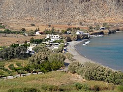
Kato Zakros ( Greek Κάτω Ζάκρος ( m. Sg. ) 'Lower Zakros') is a district of the local community Zakros on the east coast of the Greek island of Crete . Zakros is part of the Itanos parish of Sitia parish .
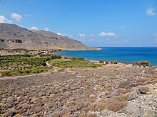
Kato Zakros, a town with 20 inhabitants (2011), is known for the archaeological excavation site of the Minoan Palace of Zakros . After the excavations were completed, the remains of the building were made accessible to the public. This led to the settlement of several taverns and accommodations on the coast, the bay of Zakros (Όρμος Ζάκρου Ormos Zakrou ), east of the palace area. In addition to this tourist attraction, the place is the starting or end point of the European long-distance hiking trail E4 in Crete, which leads from Kato Zakros through the Gorge of the Dead up to Epano Zakros (Επάνω Ζάκρος, Upper Zakros').
Individual evidence
- ↑ Results of the 2011 census at the National Statistical Service of Greece (ΕΣΥΕ) ( Memento from June 27, 2015 in the Internet Archive ) (Excel document, 2.6 MB)


