Kendall River
| Kendall River | ||
|
|
||
| Data | ||
| location | Nunavut (Canada) | |
| River system | Coppermine River | |
| Drain over | Coppermine River → Arctic Ocean | |
| origin |
Dismal Lakes 67 ° 13 '36 " N , 116 ° 36' 4" W. |
|
| Source height | approx. 255 m | |
| muzzle |
Coppermine River Coordinates: 67 ° 7 ′ 0 ″ N , 116 ° 7 ′ 0 ″ W 67 ° 7 ′ 0 ″ N , 116 ° 7 ′ 0 ″ W. |
|
| Mouth height | 217 m | |
| Height difference | approx. 38 m | |
| Bottom slope | approx. 1.3 ‰ | |
| length | approx. 30 km | |
| Discharge at the gauge close to the discharge from Dismal Lakes A Eo : 2790 km² |
MQ 1969/1990 Mq 1969/1990 |
15 m³ / s 5.4 l / (s km²) |
|
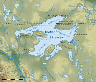
Location of the Kendall River |
||
The Kendall River is a left tributary of the Coppermine River in the Nunavut Territory of Canada .
The Kendall River drains the elongated lake system of the three Dismal Lakes . It flows from the east of the Dismal Lakes in a south-southeast direction over a distance of 30 km to the Coppermine River . The river has an average discharge of 15 m³ / s at the level near its discharge from the Dismal Lakes .
Individual evidence
- ↑ Kendall River at the gauge near the outflow from the Dismal Lakes - hydrographic data from R-ArcticNET
