
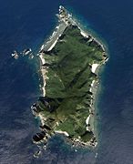
Kerama Islands
| Kerama Islands | ||
|---|---|---|
 |
||
| Waters | East China Sea | |
| archipelago | Okinawa Islands | |
| Geographical location | 26 ° 12 ′ N , 127 ° 21 ′ E | |
|
||
| Number of islands | 33 (≥ 1 ha) | |
| Main island | Tokashiki-jima | |
| Total land area | 35 km² | |
| Residents | 1643 (October 1, 2019) | |

The Kerama Islands ( Japanese 慶 良 間 諸島 , Kerama-shotō or 慶 良 間 列島 , Kerama-rettō ; Okinawaisch : Kirama ) are a group of islands in the Japanese prefecture of Okinawa in the East China Sea .
geography
The archipelago is located 20 km west of the main island of the Ryūkyū Islands , Okinawa Hontō . The next neighboring group of islands are the Keise Islands 8 km to the east, or since these are also partly included in the Kerama Islands, the island of Tonaki-jima 20 km to the northwest.
The eastern half of the archipelago is administered by the Tokashiki municipality , the western half by the Zamami municipality. However, only four islands are inhabited: Tokashiki-jima , Zamami-jima , Aka-jima and Geruma-jima. Kerama Airport is also located on Fukaji-jima .
Islands
The archipelago consists of the following islands ( -jima / -shima ) and rocks (other suffixes, unnamed entries) with an area of at least 0.01 km²: Map with all coordinates of the Islands section : OSM![]()
| Surname | Japanese | Area [km²] | Height [m] | local community | Coordinates |
|---|---|---|---|---|---|
| Tokashiki-jima | 渡 嘉 敷 島 | 15.31 | 227.3 | Tokashiki | 26 ° 11 ′ 12 "N, 127 ° 21 ′ 20" E |
| Zamami-jima | 座 間 味 島 | 6.66 | 160.7 | Zamami | 26 ° 14 ′ 4 "N, 127 ° 18 ′ 27" E |
| Aka-jima | 阿嘉 島 | 3.82 | 165.0 | Zamami | 26 ° 11 ′ 56 "N, 127 ° 16 ′ 41" E |
| Maeshima | 前 島 | 1.60 | 132.8 | Tokashiki | 26 ° 12 '44 "N, 127 ° 26' 50" E |
| Cuba shima | 久 場 島 | 1.55 | 270.1 | Zamami | 26 ° 10 ′ 17 "N, 127 ° 14 ′ 16" E |
| Yakabi-jima | 屋 嘉 比 島 | 1.26 | 214.4 | Zamami | 26 ° 12 '59 "N, 127 ° 14' 40" E |
| Geruma-jima | 慶 留 間 島 | 1.15 | 157.3 | Zamami | 26 ° 10 ′ 54 "N, 127 ° 17 ′ 21" E |
| Fukaji-shima | 外地 島 | 0.83 | 76 | Zamami | 26 ° 10 ′ 6 "N, 127 ° 17 ′ 34" E |
| Amuro-jima | 安室 島 | 0.73 | 98.8 | Zamami | 26 ° 12 ′ 26 "N, 127 ° 18 ′ 40" E |
| Gishippu-jima | 儀 志 布 島 | 0.49 | 113.6 | Tokashiki | 26 ° 13 '49 "N, 127 ° 22' 10" E |
| Kuroshima | 黒 島 | 0.27 | 126.1 | Tokashiki | 26 ° 15 ′ 6 "N, 127 ° 24 ′ 15" E |
| Un-jima | ウ ン 島 | 0.26 | 87 | Tokashiki | 26 ° 8 ′ 34 "N, 127 ° 20 ′ 35" E |
| Nakajima | 中 島 | 0.18 | 94 | Tokashiki | 26 ° 13 ′ 52 "N, 127 ° 27 ′ 2" E |
| Hate-jima | ハ テ 島 | 0.14 | - | Tokashiki | 26 ° 14 '24 "N, 127 ° 27' 26" E |
| Gahi-jima | 嘉 比 島 | 0.13 | 51 | Zamami | 26 ° 13 ′ 6 ″ N, 127 ° 17 ′ 10 ″ E |
| Gusukushima | 城 島 | 0.11 | 105.9 | Tokashiki | 26 ° 11 ′ 55 "N, 127 ° 22 ′ 40" E |
| Hanari-jima | 離島 | 0.10 | 59.2 | Tokashiki | 26 ° 9 ′ 42 "N, 127 ° 20 ′ 18" E |
| Agenashiku-jima | 安慶 名 敷 島 | 0.10 | 41.6 | Zamami | 26 ° 12 ′ 55 "N, 127 ° 17 ′ 42" E |
| Sunashiru-jima | 砂 白 島 | 0.05 | 28 | Zamami | 26 ° 11 ′ 3 ″ N, 127 ° 16 ′ 29 ″ E |
| unnamed | 0.05 | 56 | Tokashiki | 26 ° 14 '7 "N, 127 ° 27' 13" E | |
| Ou-jima (Ubu-iwa) | 奥 武 島 (う ぶ 岩) | 0.05 | 45.6 | Zamami | 26 ° 9 ′ 24 ″ N, 127 ° 16 ′ 24 ″ E |
| Achirāne-iwa | ア チ ラ ー ネ 岩 | 0.05 | - | Zamami | |
| Mokaraku-jima | モ カ ラ ク 島 | 0.04 | 25th | Zamami | 26 ° 9 '22 "N, 127 ° 17' 23" E |
| Tsumishiro-shima | 積 城 島 | 0.02 | - | Zamami | 26 ° 10 ′ 52 "N, 127 ° 16 ′ 25" E |
| Ijakaja-jima | 伊 釈 迦 釈 島 | 0.02 | 56 | Zamami | 26 ° 12 '56 "N, 127 ° 16'6" E |
| Jinojitsuru-jima | 地 自 津 留 島 | 0.01 | 54 | Tokashiki | 26 ° 14 ′ 16 "N, 127 ° 22 ′ 7" E |
| Sakuhara no Hana | 佐 久 原 の 鼻 | 0.01 | - | Zamami | 26 ° 10 ′ 42 "N, 127 ° 16 ′ 27" E |
| Fukakane-se | ふ か か ね 瀬 | 0.01 | 47 | Zamami | 26 ° 10 ′ 33 "N, 127 ° 13 ′ 45" E |
| unnamed | 0.01 | - | Zamami | 26 ° 11 ′ 0 ″ N, 127 ° 16 ′ 21 ″ E | |
| unnamed | 0.01 | - | Zamami | 26 ° 9 ′ 34 "N, 127 ° 17 ′ 31" E | |
| Cuba-iwa | く ば 岩 | 0.01 | 14th | Zamami | 26 ° 9 ′ 33 "N, 127 ° 16 ′ 23" E |
| Yubu-iwa | ゆ ぶ 岩 | 0.01 | 34 | Zamami | 26 ° 8 ′ 50 "N, 127 ° 16 ′ 11" E |
| Naka-iwa | な か 岩 | 0.01 | 17th | Zamami | 26 ° 9 ′ 1 ″ N, 127 ° 16 ′ 6 ″ E |
Note: Alternatively, instead -jima also -shima used.

Amuro-jima

Fukaji-shima

Geruma-jima

Gishippu-jima
Cuba shima

Kuroshima

Maeshima, Nakajima, unnamed island, Hatejima (bottom to top)

Naka-iwa (left), Yubu-iwa (bottom left), Ou-jima (center right) and Kuba-iwa (top right)

Yakabi-jima


Coral reefs
The archipelago has several extensive coral reefs . Two of them were placed under environmental protection as Ramsar areas in November 2005 : an area of 120 hectares along the west coast of Tokashiki-jima and around Hanari-jima, and a 233 hectare area around Ijakaja-jima, Gahi-jima and Agenashiku-jima , d. H. between Aka-jima and Zamami-jima. There are 248 different types of coral in these reefs, especially the Acropora genus . On March 5, 2014, the waters were placed under protection as the Keramashoto National Park .
Flora and fauna
The islands of Aka, Fukaji, Geruma and Yakabi form the only natural habitat of the critically endangered Kerama deer ( Cervus nippon keramae ), which was believed to be a population of the Japanese sika deer introduced in the early 17th century that has since adapted to its island environment.
history
During World War II , the Kerama Islands were the first Allied landing point on the Ryūkyū Islands. Units of the 77th Infantry Division of the US Army landed on Aka-jima on March 26, 1945, and on March 29, the entire archipelago was captured, which from then on served as a bridgehead in the subsequent Battle of Okinawa . After that, the archipelago was like the rest of the Ryūkyū Islands under US military administration before they were returned to Japan in 1972.
Web links
Individual evidence
- ↑ キ ラ マ . In: 語彙 詳細 - 首 里 ・ 那覇 方言 . Retrieved December 2, 2012 (Japanese).
- ↑ 沖 縄 県 島 し ょ 別 面積 一 覧 . Okinawa Prefecture, accessed November 13, 2013 (Japanese).
- ↑ 指定 離島 ・ 指定 離島 一 覧 . (PDF) In: 離島 関係 資料 (平 成 28 年 1 月) . 沖 縄 県 企 画 部 地域 ・ 離島 課 (“Land and Islands Unit, Planning Department, Okinawa Prefecture”), January 2016, p. 1 , accessed on 3. August 2016 (Japanese).
- ↑ presumed assignment: Listed in the source as シ マ (前 島 北) 'island (north of Maeshima)'. On the official map there is an unnamed island with the specified area at these coordinates.
- ↑ presumed assignment: Listed in the source as シ マ (砂 白 島 北) 'island (north of Sunashiru-jima)'. On the official maps there is an unnamed island with the specified area at these coordinates.
- ↑ presumed assignment: Listed in the source as シ マ (モ カ ラ ク 島 北) 'island (north of Mokaraku-jima)'. On the official maps there is an unnamed island with the specified area at these coordinates.
- ↑ Kerama-shoto Coral Reef. (PDF; 523 kB) In: Conservation and Wise Use of Rich and Diverse Wetlands: Ramsar Sites in Japan. Environment Ministry , 2008, p. 41 , accessed on November 29, 2012 (English).
- ↑ Cervus nippon keramae. National Institute for Environmental Studies, accessed June 11, 2014 .
- ^ Roy E. Appleman, James M. Burns, Russell A. Gugeler, John Stevens: Okinawa: The Last Battle . United States Government Printing Office , 2000, ISBN 0-16-061318-3 , pp. 52–56 ( limited preview in Google Book Search - first published in 1948).