Ketelsbüttel
|
Ketelsbüttel
Wöhrden municipality
Coordinates: 54 ° 8 ′ 45 ″ N , 9 ° 0 ′ 58 ″ E
|
||
|---|---|---|
| Height : | 2 m above sea level NN | |
| Area : | 5.5 km² | |
| Residents : | 180 | |
| Population density : | 33 inhabitants / km² | |
| Incorporation : | 1st January 1974 | |
| Incorporated into: | Süderwöhrden | |
| Postal code : | 25797 | |
| Area code : | 04839 | |
|
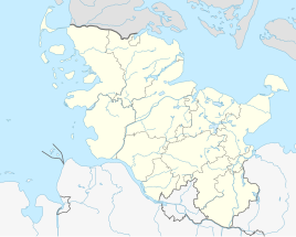
Location of Ketelsbüttel in Schleswig-Holstein |
||
Ketelsbüttel is a small district of Wöhrden about three kilometers away . Ketelsbüttel belongs to the KLG Heider-Umland district and is located in the Dithmarschen district in Schleswig-Holstein .
Ketelsbüttel has about 180 inhabitants. Some agricultural and commercial operations are located here.
Ketelsbüttel also belongs to the parish of Wöhrden. Hemmingstedt used to be a parish.
history
On April 1, 1934, the parish of Nordermeldorf was dissolved. All of their village communities, village communities and farmers became independent communities / rural communities, including Ketelsbüttel. The name of the village Ketelsbüttel comes from the Wöhrden Low German, for which a separate dictionary was written (Woierner Wöör). In High German it means, directly translated, boiler bags. The artificial Wurth, which describes Ketelsbüttels Dorfstrasse over the elevation from southwest to northeast, which the farmers of Ketelsbüttles heaped with kettles and bags in its earliest times, has since given its name. The name of the community Wöhrden has this meaning in its Low German, the Wurthen or the Terps. These describe an elevation that protects the residents and their cattle from the sea (in this case the North Sea), similar to the Halligen, which, however, were built further upstream in the North Sea.
On January 1, 1974, Ketelsbüttel was incorporated into the former municipality of Süderwöhrden, which was renamed Wöhrden on May 1, 1978.
Associations and associations
- Ketelsbüttel volunteer fire department
- Ring riding club Ketelsbüttel
Individual evidence
- ↑ State Statistical Office Schleswig-Holstein (ed.): The population of the communities in Schleswig-Holstein 1867 - 1970 . State Statistical Office Schleswig-Holstein, Kiel 1972, p. 250 .
- ^ Federal Statistical Office (ed.): Historical municipality directory for the Federal Republic of Germany. Name, border and key number changes in municipalities, counties and administrative districts from May 27, 1970 to December 31, 1982 . W. Kohlhammer GmbH, Stuttgart and Mainz 1983, ISBN 3-17-003263-1 , p. 181 .
