Kirchberg (Eckardtshausen)
| Kirchberg | ||
|---|---|---|
|
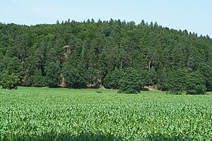
Partial view from the southeast (2012) |
||
| height | 353.3 m above sea level NN | |
| location | Thuringia ( Germany ) | |
| Mountains | Thuringian Forest | |
| Coordinates | 50 ° 55 '32 " N , 10 ° 16' 45" E | |
|
|
||
| rock | Wartburg conglomerate | |
| particularities | Desolation | |
The Kirchberg is a 353.3 m high mountain in Eckardtshausen ( Gerstungen municipality ) in the Wartburg district in Thuringia .
location
The Kirchberg is located in the Eltetal , about one kilometer northeast of Eckardtshausen. The source streams Klinge and Attchenbach, which flow into the Elte as left tributaries, arise in the valley floor near Eckardtshausen and flow around the Kirchberg.
history
The field name "Kirchberg" refers to the location of the oldest church in the upper Elte Valley. This high medieval foundation on the Kirchberg, handed down as the Sedes Church , included a village which, according to local tradition, was located in the Wiesengrund directly south of the Kirchberg. The field name "Das Gebrannte" is reminiscent of this desert . Traces of the former church have not yet been discovered.
Individual evidence
- ↑ Official topographic maps of Thuringia 1: 10,000. Wartburgkreis, district of Gotha, district-free city of Eisenach . In: Thuringian Land Survey Office (Hrsg.): CD-ROM series Top10 . CD 2. Erfurt 1999.

