Kirchschemmsbach
| Kirchschemmsbach | ||
|
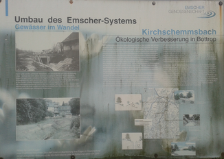
Sign for the reconstruction phase of the Kirschemnsbach on Gladbeckerstraße |
||
| Data | ||
| Water code | DE : 2772652 | |
| location | North Rhine-Westphalia , Germany | |
| River system | Rhine | |
| Drain over | Boye → Emscher → Rhine → North Sea | |
| source | in Bottrop 51 ° 31 '48 " N , 6 ° 55' 23" E |
|
| muzzle | in the Boye coordinates: 51 ° 33 ′ 11 " N , 6 ° 56 ′ 54" E 51 ° 33 ′ 11 " N , 6 ° 56 ′ 54" E
|
|
| length | 3.2 km | |
| Big cities | Bottrop | |
The Kirschemmsbach is a right tributary of the Boye in the Ruhr area . It is 3.2 kilometers long and drains an area of 6 km². The course of the stream runs entirely on Bottrop's urban area.
Flood
In 1938 the brook burst its banks and caused several houses to collapse.
history
The recent history of the brook is closely linked to the industrialization of the Ruhr area. Triggered by coal mining and the associated rapidly increasing population development, it became necessary to discharge the waste water for the populated areas around the stream. An underground possibility was technically not possible due to the earth displacement, which also took place due to the underground coal mining in the region. The brook was used as a Köttelbecke for decades . In 2001 an underground sewer was built. At the same time, the stream was renatured again as part of the project to convert the Emscher system .
Web links
- Course of the Kirschemmsbach on the GIS Bottrop
Individual evidence
- ↑ Topographical Information Management, Cologne District Government, Department GEObasis NRW ( Notes )
- ↑ Severe weather catastrophe in Bottrop ( page no longer available , search in web archives ) Info: The link was automatically marked as defective. Please check the link according to the instructions and then remove this notice.
- ↑ CLEAN KIRSCHEMMSBACH AFTER 2001
