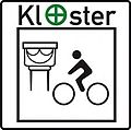
Monastery bike path
| Monastery bike path | |
|---|---|

|
|
| overall length | 18 km |
| location | Königsee in the district of Saalfeld-Rudolstadt |
| Starting point |
Leutnitz 50 ° 41 ′ 44 ″ N , 11 ° 12 ′ 37 ″ E |
| Target point |
Königsee 50 ° 39 ′ 48 ″ N , 11 ° 5 ′ 50 ″ E |
| Places along the way | Leutnitz, Solsdorf , Hengelbach , Paulinzella , Königsee |
| Flooring | Asphalt 70% water-bound surface 30% |
| Height difference | 100 m |
| difficulty | light |
| Connection to | Rinnetal cycle path in Königsee |
| Website URL | http://www.gemeinderottenbach.de/frontend/?func=view&t1=12&t2=74&d=1 |
The monastery cycle path is an approximately 18 km long regional cycle path in the area of the small town of Königsee in the Saalfeld-Rudolstadt district of Thuringia .
Route
The monastery cycle path begins in the Leutnitz district and leads through the Solsdorf , Hengelbach and Paulinzella districts to Königsee . It connects the Rinnetal-Radwanderweg near Leutnitz, some of which is still under construction, with the Rinnetal-Radwanderweg in Königsee, which will continue to the Ilmtal-Radweg near Gräfinau-Angstedt .
Sights along the way
Paulinzella Monastery , a former Benedictine monastery in Paulinzella
See also
Individual evidence
- ↑ Rottenbach community - monastery cycle path. (No longer available online.) Archived from the original on October 6, 2014 ; accessed on October 12, 2014 . Info: The archive link was inserted automatically and has not yet been checked. Please check the original and archive link according to the instructions and then remove this notice.