Knieberg (Unkeroda)
| Knieberg | ||
|---|---|---|
|
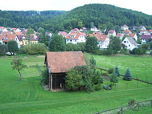
View over Unkeroda to Knieberg |
||
| height | 375.6 m above sea level NN | |
| location | Thuringia ( Germany ) | |
| Mountains | Thuringian Forest | |
| Coordinates | 50 ° 55 ′ 45 " N , 10 ° 16 ′ 11" E | |
|
|
||
| rock | Wartburg conglomerate, copper slate | |
| particularities | Old mining | |
The Knieberg is a 375.6 m high mountain near Wolfsburg-Unkeroda in the Wartburg district in Thuringia .
The Knieberg is located in the Eltetal on the south side of the Thuringian Forest. On the east side of Knieberges there are several pings, heaps and remains of tunnels from the early modern copper slate mining near Unkeroda. The Attchenbach smelter was located at the foot of the Knieberges. The last mining activity was only stopped in 1858 by the "Sächsisch-Thüringische Hütten- und Bergbaugesellschaft". Ines walk, Thomas Grasselt, Roland Geyer: Wartburgkreis, Süd . Ed .: Thuringian State Office for Archaeological Monument Preservation (= Archaeological Hiking Guide Thuringia . No. 12 ). Beier & Beran, Weimar 2011, ISBN 978-3-941171-41-1 .
Individual evidence
- ↑ Official topographic maps of Thuringia 1: 10,000. Wartburgkreis, district of Gotha, district-free city of Eisenach . In: Thuringian Land Survey Office (Hrsg.): CD-ROM series Top10 . CD 2. Erfurt 1999.

