Kock's hole
| Kock's hole | ||
|---|---|---|

|
||
| Kocks Hole (2009) | ||
| Geographical location | Mülheim an der Ruhr , North Rhine-Westphalia , Germany | |
| Data | ||
| Coordinates | 51 ° 23 '57 " N , 6 ° 53' 41" E | |
|
|
||
| Altitude above sea level | 40 m above sea level NHN | |
| surface | 20 ha | |
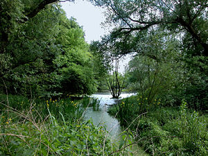
Kocks Loch is an oxbow lake area of the Ruhr in the city of Mülheim an der Ruhr . The area is recorded in the biotope register of North Rhine-Westphalia and is part of the much larger Saarn-Mendener Ruhraue nature reserve . In addition, Kocks Loch is part of the FFH area DE-4507-301 Ruhraue in Mülheim .
development
Until the 1970s, there was still a wild garbage dump on the eastern side of the Ruhraue. This was later covered with earth. The old "treasures" including refrigerators still rest and rust there.
In 1982, Kocks Loch was the city's first designated nature reserve. This later went on in the NSG Saarn-Mendener Ruhraue. Access to the floodplain forest was made more difficult by newly dug water ditches, some of which were renatured old arms of the Ruhr, and the area was largely protected from vandalism in this way, so that rare animal species such as B. the kingfisher , could find their home. Also otters can be observed on the water areas of Kocks hole.
See also
Individual evidence
- ↑ Nature reserve "Saarn-Mendener Ruhraue" with protected biotope Ruhraue "Kocks Loch" BK-4507-905 in the specialist information system of the State Office for Nature, Environment and Consumer Protection North Rhine-Westphalia , accessed on February 23, 2017.
- ^ Landscape plan, Mülheimer Ruraue


